 |
|
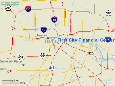
First City Financial Center Heliport |
Location & QuickFacts
| FAA Information Effective: | 2008-09-25 |
| Airport Identifier: | 4TS0 |
| Airport Status: | Operational |
| Longitude/Latitude: | 095-21-55.7770W/29-45-13.8210N
-95.365494/29.753839 (Estimated) |
| Elevation: | 482 ft / 146.91 m (Estimated) |
| Land: | 0 acres |
| From nearest city: | 0 nautical miles N of Houston, TX |
| Location: | Harris County, TX |
| Magnetic Variation: | 06E (1985) |
Owner & Manager
| Ownership: | Privately owned |
| Owner: | 1st Cith Natl Bank Of Texas |
| Address: | 1301 Fannin, Suite 2282
Houston, TX 77002 |
| Phone number: | 713-658-7559 |
| Manager: | Bruce C. Edwards |
| Address: | 1301 Fannin, Suite 2282
Houston, TX 77002 |
| Phone number: | 713-658-7044 |
Airport Operations and Facilities
| Airport Use: | Private
PPR TO LND CTC SECURITY CTL - 713-658-6565. |
| Wind indicator: | Yes |
| Segmented Circle: | No |
| Control Tower: | No |
| Lighting Schedule: | RDO-CTL
ACTVT FLOOD LGTS - 122.85. |
| Sectional chart: | Houston |
| Region: | ASW - Southwest |
| Boundary ARTCC: | ZHU - Houston |
| Tie-in FSS: | CXO - Montgomery County |
| FSS on Airport: | No |
| FSS Toll Free: | 1-800-WX-BRIEF
FOR FP FILING CALL CXO FSS 1-800-833-5602. |
Runway Information
Helipad H1
| Dimension: | 63 x 63 ft / 19.2 x 19.2 m |
| Surface: | CONC,
ROOFTOP. |
| |
Runway H1 |
Runway |
| Traffic Pattern: | Left | Left |
|
Radio Navigation Aids
| ID |
Type |
Name |
Ch |
Freq |
Var |
Dist |
| SYG | NDB | Sandy Point | | 402.00 | 05E | 16.0 nm |
| JPA | NDB | Sanjac | | 347.00 | 05E | 16.3 nm |
| BVP | NDB | Nixin | | 326.00 | 05E | 16.4 nm |
| LYD | NDB | Lakeside | | 249.00 | 05E | 16.7 nm |
| SGR | NDB | Hull | | 388.00 | 05E | 16.8 nm |
| EYQ | NDB | Weiser | | 286.00 | 06E | 18.0 nm |
| DWH | NDB | David Hooks | | 521.00 | 05E | 24.7 nm |
| CBC | NDB | Anahuac | | 413.00 | 05E | 36.7 nm |
| GLS | NDB | Galveston | | 206.00 | 08E | 40.6 nm |
| EFD | TACAN | Ellington | 031X | | 05E | 13.9 nm |
| HUB | VOR/DME | Hobby | 118X | 117.10 | 05E | 7.5 nm |
| MHF | VOR/DME | Trinity | 083X | 113.60 | 07E | 34.6 nm |
| ELA | VOR/DME | Eagle Lake | 111X | 116.40 | 08E | 50.0 nm |
| IAH | VORTAC | Humble | 113X | 116.60 | 05E | 12.3 nm |
| VUH | VORTAC | Scholes | 077X | 113.00 | 06E | 39.1 nm |
| DAS | VORTAC | Daisetta | 116X | 116.90 | 05E | 45.8 nm |
| TNV | VORTAC | Navasota | 106X | 115.90 | 08E | 48.3 nm |
| HOU | VOT | Houston Wm P Hobby | | 108.40 | | 8.0 nm |
Remarks
- PRVDD GADO IS NOTIFIED PRIOR TO OPERNS, FOR FINAL CHECK.
Images and information placed above are from
http://www.airport-data.com/airport/4TS0/
We thank them for the data!
| General Info
|
| Country |
United States
|
| State |
TEXAS
|
| FAA ID |
4TS0
|
| Latitude |
29-45-13.821N
|
| Longitude |
095-21-55.777W
|
| Elevation |
482 feet
|
| Near City |
HOUSTON
|
We don't guarantee the information is fresh and accurate. The data may
be wrong or outdated.
For more up-to-date information please refer to other sources.
|
|


