 |
|
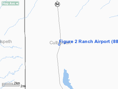
Location & QuickFacts
| FAA Information Effective: | 2008-09-25 |
| Airport Identifier: | 88TA |
| Airport Status: | Operational |
| Longitude/Latitude: | 104-50-39.7900W/31-27-21.4500N
-104.844386/31.455958 (Estimated) |
| Elevation: | 3700 ft / 1127.76 m (Estimated) |
| Land: | 0 acres |
| From nearest city: | 24 nautical miles N of Van Horn, TX |
| Location: | Culberson County, TX |
| Magnetic Variation: | 10E (1995) |
Owner & Manager
| Ownership: | Privately owned |
| Owner: | Ronald P Stasny |
| Address: | 37 Encino Loma
Beeville, TX 67192 |
| Phone number: | 512-358-7515 |
| Manager: | Ronald P Stasny |
| Address: | 37 Encino Loma
Beeville, TX 67192 |
| Phone number: | 512-358-7515 |
Airport Operations and Facilities
| Airport Use: | Private |
| Wind indicator: | Yes |
| Segmented Circle: | No |
| Control Tower: | No |
| Sectional chart: | El Paso |
| Region: | ASW - Southwest |
| Boundary ARTCC: | ZAB - Albuquerque |
| Tie-in FSS: | ABQ - Albuquerque |
| FSS on Airport: | No |
| FSS Toll Free: | 1-800-WX-BRIEF |
Runway Information
Runway 01/19
| Dimension: | 4000 x 75 ft / 1219.2 x 22.9 m |
| Surface: | TURF, |
| |
Runway 01 |
Runway 19 |
| Traffic Pattern: | Left | Left |
|
Radio Navigation Aids
| ID |
Type |
Name |
Ch |
Freq |
Var |
Dist |
| VHN | NDB | Van Horn | | 233.00 | 10E | 23.9 nm |
| SFL | VORTAC | Salt Flat | 077X | 113.00 | 12E | 21.5 nm |
| HUP | VORTAC | Hudspeth | 097X | 115.00 | 12E | 28.1 nm |
Remarks
- 5 FT CATTLE PENS 100 FT FM AER 19.
Images and information placed above are from
http://www.airport-data.com/airport/88TA/
We thank them for the data!
| General Info
|
| Country |
United States
|
| State |
TEXAS
|
| FAA ID |
88TA
|
| Latitude |
31-27-21.450N
|
| Longitude |
104-50-39.790W
|
| Elevation |
3700 feet
|
| Near City |
VAN HORN
|
We don't guarantee the information is fresh and accurate. The data may
be wrong or outdated.
For more up-to-date information please refer to other sources.
|
|


