 |
|
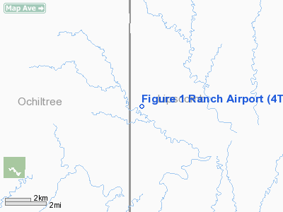
Location & QuickFacts
| FAA Information Effective: | 2008-09-25 |
| Airport Identifier: | 4TE1 |
| Airport Status: | Operational |
| Longitude/Latitude: | 100-32-06.5120W/36-16-01.1300N
-100.535142/36.266981 (Estimated) |
| Elevation: | 2631 ft / 801.93 m (Estimated) |
| Land: | 0 acres |
| From nearest city: | 11 nautical miles S of Booker, TX |
| Location: | Lipscomb County, TX |
| Magnetic Variation: | 09E (1985) |
Owner & Manager
| Ownership: | Privately owned |
| Owner: | W. T. Tregellas |
| Address: | 2017 Sw 21st
Perryton, TX 79070 |
| Phone number: | 806-658-2209 |
| Address: |
|
Airport Operations and Facilities
| Airport Use: | Private |
| Wind indicator: | Yes |
| Segmented Circle: | No |
| Control Tower: | No |
| Landing fee charge: | No |
| Sectional chart: | Wichita |
| Region: | ASW - Southwest |
| Boundary ARTCC: | ZKC - Kansas City |
| Tie-in FSS: | FTW - Fort Worth |
| FSS on Airport: | No |
| FSS Phone: | 817-541-3474 |
| FSS Toll Free: | 1-800-WX-BRIEF |
Airport Services
| Fuel available: | 100 |
| Airframe Repair: | NONE |
| Power Plant Repair: | NONE |
Runway Information
Runway 13/31
| Dimension: | 1900 x 80 ft / 579.1 x 24.4 m |
| Surface: | TURF, |
| |
Runway 13 |
Runway 31 |
| Traffic Pattern: | Left | Left |
|
Runway 18/36
| Dimension: | 1900 x 80 ft / 579.1 x 24.4 m |
| Surface: | TURF, |
| |
Runway 18 |
Runway 36 |
| Traffic Pattern: | Left | Left |
|
Radio Navigation Aids
| ID |
Type |
Name |
Ch |
Freq |
Var |
Dist |
| PYX | NDB | Perryton | | 266.00 | 09E | 13.5 nm |
| HHF | NDB | Hemphill County | | 400.00 | 08E | 23.5 nm |
| PPA | NDB | Pampa | | 368.00 | 09E | 45.2 nm |
| OWU | NDB | West Woodward | | 329.00 | 08E | 50.0 nm |
| GAG | VORTAC | Gage | 103X | 115.60 | 10E | 32.1 nm |
| BGD | VORTAC | Borger | 023X | 108.60 | 11E | 49.6 nm |
Images and information placed above are from
http://www.airport-data.com/airport/4TE1/
We thank them for the data!
| General Info
|
| Country |
United States
|
| State |
TEXAS
|
| FAA ID |
4TE1
|
| Latitude |
36-16-01.130N
|
| Longitude |
100-32-06.512W
|
| Elevation |
2631 feet
|
| Near City |
BOOKER
|
We don't guarantee the information is fresh and accurate. The data may
be wrong or outdated.
For more up-to-date information please refer to other sources.
|
|


