 |
|
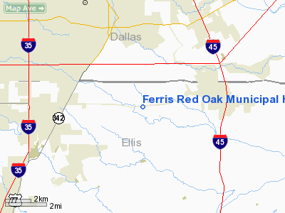
Ferris Red Oak Muni Heliport |
Location & QuickFacts
| FAA Information Effective: | 2008-09-25 |
| Airport Identifier: | 12T |
| Airport Status: | Operational |
| Longitude/Latitude: | 096-43-40.4800W/32-31-44.9900N
-96.727911/32.529164 (Estimated) |
| Elevation: | 510 ft / 155.45 m (Estimated) |
| Land: | 1 acres |
| From nearest city: | 4 nautical miles N of Ferris/red Oak, TX |
| Location: | Ellis County, TX |
| Magnetic Variation: | 06E (1995) |
Owner & Manager
| Ownership: | Publicly owned |
| Owner: | Cities Of Ferris & Red Oak
AND CITY OF RED OAK, 411 W RED OAK RD, RED OAK TX 75154, PHONE 214-617-8239. |
| Address: | 100 Town Plaza
Ferris, TX 75125 |
| Phone number: | 214-972-2110 |
| Manager: | Doug Mcham |
| Address: | 201 S Church
Ferris, TX 75125 |
| Phone number: | 972-544-2225
OR 214-908-9303. |
Airport Operations and Facilities
| Airport Use: | Open to public |
| Wind indicator: | Yes |
| Segmented Circle: | No |
| Control Tower: | No |
| Sectional chart: | Dallas-ft Worth |
| Region: | ASW - Southwest |
| Boundary ARTCC: | ZFW - Fort Worth |
| Tie-in FSS: | FTW - Fort Worth |
| FSS on Airport: | No |
| FSS Phone: | 817-541-3474 |
| FSS Toll Free: | 1-800-WX-BRIEF |
| NOTAMs Facility: | FTW (NOTAM-d service avaliable) |
Airport Communications
Runway Information
Helipad H1
| Dimension: | 40 x 40 ft / 12.2 x 12.2 m |
| Surface: | CONC, |
| |
Runway H1 |
Runway |
| Traffic Pattern: | Left | Left |
| Markings: | Basic, Fair Condition | , |
|
Radio Navigation Aids
| ID |
Type |
Name |
Ch |
Freq |
Var |
Dist |
| LNC | NDB | Lancaster | | 239.00 | 06E | 2.9 nm |
| RBD | NDB | Redbird | | 287.00 | 06E | 11.5 nm |
| JUG | NDB | Jecca | | 388.00 | 06E | 13.0 nm |
| XQH | NDB | Cedar Hill | | 353.00 | 08E | 13.1 nm |
| PQF | NDB | Mesquite | | 248.00 | 06E | 19.6 nm |
| AVZ | NDB | Travis | | 260.00 | 06E | 27.9 nm |
| CGQ | NDB | Powell | | 344.00 | 06E | 31.8 nm |
| CRS | NDB | Corsicana | | 396.00 | 06E | 34.6 nm |
| MII | NDB | Caddo Mills | | 316.00 | 06E | 39.1 nm |
| SYW | NDB | Cash | | 428.00 | 05E | 43.1 nm |
| CSZ | NDB | Crossroads | | 215.00 | 08E | 48.1 nm |
| PYF | NDB | Pyramid | | 418.00 | 06E | 48.3 nm |
| NFW | TACAN | Nas Jrb Fort Worth | 024X | | 07E | 38.8 nm |
| MJF | TACAN | Arvilla | 033X | | 05E | 46.7 nm |
| CVE | VOR/DME | Cowboy | 109X | 116.20 | 06E | 23.5 nm |
| TTT | VOR/DME | Maverick | 078X | 113.10 | 06E | 25.8 nm |
| FUZ | VORTAC | Ranger | 104X | 115.70 | 06E | 31.5 nm |
| CQY | VORTAC | Cedar Creek | 095X | 114.80 | 06E | 33.1 nm |
| DAL | VOT | Dallas Love Field | | 113.30 | | 20.1 nm |
| FTW | VOT | Fort Worth Meacham | | 108.20 | | 36.3 nm |
Images and information placed above are from
http://www.airport-data.com/airport/12T/
We thank them for the data!
| General Info
|
| Country |
United States
|
| State |
TEXAS
|
| FAA ID |
12T
|
| Latitude |
32-31-44.990N
|
| Longitude |
096-43-40.480W
|
| Elevation |
510 feet
|
| Near City |
FERRIS/RED OAK
|
We don't guarantee the information is fresh and accurate. The data may
be wrong or outdated.
For more up-to-date information please refer to other sources.
|
|


