 |
|
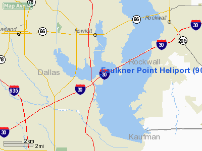
Location & QuickFacts
| FAA Information Effective: | 2008-09-25 |
| Airport Identifier: | 90TA |
| Airport Status: | Operational |
| Longitude/Latitude: | 096-32-25.9640W/32-52-00.4500N
-96.540546/32.866792 (Estimated) |
| Elevation: | 460 ft / 140.21 m (Estimated) |
| Land: | 0 acres |
| From nearest city: | 5 nautical miles SE of Garland, TX |
| Location: | Dallas County, TX |
| Magnetic Variation: | 06E (1985) |
Owner & Manager
| Ownership: | Privately owned |
| Owner: | Danny L. Faulkner |
| Address: | 1785 E I30
Garland, TX 75043 |
| Phone number: | 214-240-6262 |
| Manager: | Danny L. Faulkner |
| Address: | 1785 E I30
Garland, TX 75043 |
| Phone number: | 214-240-6262 |
Airport Operations and Facilities
| Airport Use: | Private |
| Wind indicator: | Yes |
| Segmented Circle: | No |
| Control Tower: | No |
| Landing fee charge: | No |
| Sectional chart: | Dallas-ft Worth |
| Region: | ASW - Southwest |
| Boundary ARTCC: | ZFW - Fort Worth |
| Tie-in FSS: | FTW - Fort Worth |
| FSS on Airport: | No |
| FSS Phone: | 817-541-3474 |
| FSS Toll Free: | 1-800-WX-BRIEF |
Airport Communications
Runway Information
Helipad H1
| Dimension: | 200 x 200 ft / 61.0 x 61.0 m |
| Surface: | CONC, |
| |
Runway H1 |
Runway |
| Traffic Pattern: | Left | Left |
|
Radio Navigation Aids
| ID |
Type |
Name |
Ch |
Freq |
Var |
Dist |
| PQF | NDB | Mesquite | | 248.00 | 06E | 3.5 nm |
| JUG | NDB | Jecca | | 388.00 | 06E | 12.0 nm |
| AVZ | NDB | Travis | | 260.00 | 06E | 16.1 nm |
| MII | NDB | Caddo Mills | | 316.00 | 06E | 18.0 nm |
| LNC | NDB | Lancaster | | 239.00 | 06E | 19.6 nm |
| RBD | NDB | Redbird | | 287.00 | 06E | 20.2 nm |
| SYW | NDB | Cash | | 428.00 | 05E | 24.9 nm |
| XQH | NDB | Cedar Hill | | 353.00 | 08E | 27.6 nm |
| HJM | NDB | Rayburn | | 415.00 | 06E | 48.5 nm |
| CGQ | NDB | Powell | | 344.00 | 06E | 48.6 nm |
| MJF | TACAN | Arvilla | 033X | | 05E | 27.0 nm |
| NFW | TACAN | Nas Jrb Fort Worth | 024X | | 07E | 45.8 nm |
| CVE | VOR/DME | Cowboy | 109X | 116.20 | 06E | 18.4 nm |
| TTT | VOR/DME | Maverick | 078X | 113.10 | 06E | 25.2 nm |
| FUZ | VORTAC | Ranger | 104X | 115.70 | 06E | 32.3 nm |
| BYP | VORTAC | Bonham | 093X | 114.60 | 06E | 43.2 nm |
| CQY | VORTAC | Cedar Creek | 095X | 114.80 | 06E | 44.1 nm |
| DAL | VOT | Dallas Love Field | | 113.30 | | 15.8 nm |
| FTW | VOT | Fort Worth Meacham | | 108.20 | | 41.4 nm |
Remarks
- PROVIDED PLINES ARE MARKED OR INGRESS/EGRESS BE RESTRICTED FROM BEING OVER THESE LINES; OPNS LIMITED TO DAY TIME VFR; PAD REMAIN PVT USE; WIND INDICATOR BE INSTALLED.
Images and information placed above are from
http://www.airport-data.com/airport/90TA/
We thank them for the data!
| General Info
|
| Country |
United States
|
| State |
TEXAS
|
| FAA ID |
90TA
|
| Latitude |
32-52-00.450N
|
| Longitude |
096-32-25.964W
|
| Elevation |
460 feet
|
| Near City |
GARLAND
|
We don't guarantee the information is fresh and accurate. The data may
be wrong or outdated.
For more up-to-date information please refer to other sources.
|
|


