 |
|
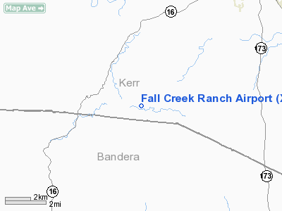
Location & QuickFacts
| FAA Information Effective: | 2008-09-25 |
| Airport Identifier: | XA43 |
| Airport Status: | Operational |
| Longitude/Latitude: | 099-12-24.8500W/29-54-29.2000N
-99.206903/29.908111 (Estimated) |
| Elevation: | 2030 ft / 618.74 m (Estimated) |
| Land: | 0 acres |
| From nearest city: | 9 nautical miles S of Kerrville, TX |
| Location: | Kerr County, TX |
| Magnetic Variation: | () |
Owner & Manager
| Ownership: | Privately owned |
| Owner: | Macdonald Phoenix Llc |
| Address: | 2951 Fall Creek Rd
Kerrville, TX 78028 |
| Phone number: | 830-257-5323 |
| Manager: | T. Justin Macdonald |
| Address: | 2951, Fall Creek Rd
Kerrville, TX 78028 |
| Phone number: | 830-257-5323 |
Airport Operations and Facilities
| Airport Use: | Private |
| Wind indicator: | Yes |
| Control Tower: | No |
| Sectional chart: | San Antonio |
| Region: | ASW - Southwest |
| Boundary ARTCC: | ZHU - Houston |
| Tie-in FSS: | SJT - San Angelo |
| FSS Toll Free: | 1-800-WX-BRIEF |
Runway Information
Runway 12/30
| Dimension: | 2350 x 50 ft / 716.3 x 15.2 m |
| Surface: | ASPH, |
| |
Runway 12 |
Runway 30 |
| Traffic Pattern: | Left | Left |
|
Radio Navigation Aids
| ID |
Type |
Name |
Ch |
Freq |
Var |
Dist |
| ER | NDB | Shein | | 263.00 | 08E | 10.3 nm |
| HMA | NDB | Hondo | | 329.00 | 08E | 32.2 nm |
| CVB | NDB | Castroville | | 338.00 | 08E | 38.6 nm |
| HHH | NDB | Devine | | 359.00 | 07E | 48.3 nm |
| KSY | TACAN | Kelly | 057X | | 07E | 45.1 nm |
| HDO | VOR/DME | Hondo | 31X | 109.40 | 08E | 33.6 nm |
| CSI | VORTAC | Center Point | 122X | 117.50 | 08E | 0.9 nm |
| STV | VORTAC | Stonewall | 085X | 113.80 | 08E | 31.7 nm |
| SAT | VORTAC | San Antonio | 115X | 116.80 | 08E | 42.0 nm |
| SAT | VOT | San Antonio Intl | | 110.40 | | 44.6 nm |
Remarks
Images and information placed above are from
http://www.airport-data.com/airport/XA43/
We thank them for the data!
|
|


