 |
|
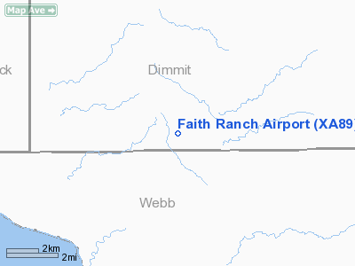
Location & QuickFacts
| FAA Information Effective: | 2008-09-25 |
| Airport Identifier: | XA89 |
| Airport Status: | Operational |
| Longitude/Latitude: | 100-01-07.8900W/28-12-31.0400N
-100.018858/28.208622 (Estimated) |
| Elevation: | 772 ft / 235.31 m (Surveyed) |
| Land: | 267 acres |
| From nearest city: | 21 nautical miles SW of Carrizo Springs, TX |
| Location: | Dimmit County, TX |
| Magnetic Variation: | () |
Owner & Manager
| Ownership: | Privately owned |
| Owner: | Faith Ranch Lp |
| Address: | Po Box 7
Houston, TX 77001 |
| Phone number: | 713-520-0400 |
| Manager: | Faith Ranch Lp |
| Address: | Po Box 7
Houston, TX 77001 |
| Phone number: | 713-520-0400 |
Airport Operations and Facilities
| Airport Use: | Private |
| Wind indicator: | Yes |
| Control Tower: | No |
| Sectional chart: | San Antonio |
| Region: | ASW - Southwest |
| Boundary ARTCC: | ZHU - Houston |
| Tie-in FSS: | SJT - San Angelo |
| FSS Toll Free: | 1-800-WX-BRIEF |
Runway Information
Runway 14/32
| Dimension: | 5305 x 75 ft / 1617.0 x 22.9 m |
| Surface: | ASPH, Good Condition |
| |
Runway 14 |
Runway 32 |
| Traffic Pattern: | Left | Right |
| Markings: | Non-precision instrument, Good Condition | Non-precision instrument, Good Condition |
|
Radio Navigation Aids
| ID |
Type |
Name |
Ch |
Freq |
Var |
Dist |
| DMD | NDB | Dimmit County | | 343.00 | 07E | 21.4 nm |
| CPZ | NDB | Chaparrosa Ranch | | 385.00 | 10E | 42.2 nm |
| LKX | NDB | La Pryor | | 223.00 | 09E | 44.2 nm |
Images and information placed above are from
http://www.airport-data.com/airport/XA89/
We thank them for the data!
| General Info
|
| Country |
United States
|
| State |
TEXAS
|
| FAA ID |
XA89
|
| Latitude |
28.208667
28° 12' 31.20" N
|
| Longitude |
-100.018889
100° 01' 08.00" W
|
| Elevation |
768 feet
234 meters
|
| Magnetic Variation |
006° E (08/06)
|
| Operating Agency |
PRIVATE
|
We don't guarantee the information is fresh and accurate. The data may
be wrong or outdated.
For more up-to-date information please refer to other sources.
|
|


