 |
|
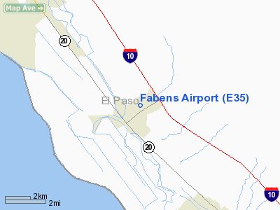
Location & QuickFacts
| FAA Information Effective: | 2008-09-25 |
| Airport Identifier: | E35 |
| Airport Status: | Operational |
| Longitude/Latitude: | 106-08-49.9120W/31-30-56.4230N
-106.147198/31.515673 (Estimated) |
| Elevation: | 3679 ft / 1121.36 m (Surveyed) |
| Land: | 270 acres |
| From nearest city: | 1 nautical miles NE of Fabens, TX |
| Location: | El Paso County, TX |
| Magnetic Variation: | 11E (1985) |
Owner & Manager
| Ownership: | Publicly owned |
| Owner: | El Paso County |
| Address: | 212 City-county Bldg
El Paso, TX 79901 |
| Phone number: | 915-546-2098 |
| Manager: | Alfredo Olivas |
| Address: | Box 848
Fabens, TX 79838 |
| Phone number: | 915-764-3549
ALTERNATE PHONE: 915-637-4450. |
Airport Operations and Facilities
| Airport Use: | Open to public |
| Wind indicator: | Yes |
| Segmented Circle: | Yes |
| Control Tower: | No |
| Lighting Schedule: | RDO-CTL
ACTVT ROTG BCN & LIRL RY 08/26 - CTAF. |
| Beacon Color: | Clear-Green (lighted land airport) |
| Landing fee charge: | No |
| Sectional chart: | El Paso |
| Region: | ASW - Southwest |
| Boundary ARTCC: | ZAB - Albuquerque |
| Tie-in FSS: | ABQ - Albuquerque |
| FSS on Airport: | No |
| FSS Toll Free: | 1-800-WX-BRIEF |
| NOTAMs Facility: | ABQ (NOTAM-d service avaliable) |
| Federal Agreements: | N |
Airport Communications
| CTAF: | 122.800 |
| Unicom: | 122.800 |
Airport Services
| Fuel available: | 100LL |
| Airframe Repair: | MAJOR |
| Power Plant Repair: | MAJOR |
| Bottled Oxygen: | NONE |
| Bulk Oxygen: | NONE |
Runway Information
Runway 08/26
| Dimension: | 4200 x 60 ft / 1280.2 x 18.3 m |
| Surface: | ASPH, Good Condition |
| Weight Limit: | Single wheel: 25000 lbs. |
| Edge Lights: | Low |
| |
Runway 08 |
Runway 26 |
| Traffic Pattern: | Left | Left |
| Markings: | Basic, Good Condition | Basic, Good Condition |
| Displaced threshold: | 190.00 ft | 0.00 ft |
| Obstruction: | 5 ft pole, 228.0 ft from runway, 14 ft right of centerline, 5:1 slope to clear
APCH RATIO 40:1 TO DSPLCD THLD. | 92 ft ant, 1950.0 ft from runway, 125 ft left of centerline, 19:1 slope to clear
+4 FT TREE, 143 FT FM RY END, 50 FT RGT. |
|
Runway 16/34
| Dimension: | 2300 x 35 ft / 701.0 x 10.7 m |
| Surface: | ASPH, Good Condition |
| |
Runway 16 |
Runway 34 |
| Traffic Pattern: | Left | Left |
| Markings: | Basic, Good Condition | Nonstandard, Good Condition
DSPLCD THLD BAR MISSING. |
| Displaced threshold: | 0.00 ft | 100.00 ft |
| Obstruction: | 3 ft brush, 205.0 ft from runway, 50 ft left of centerline | 12 ft bldg, 275.0 ft from runway, 45 ft right of centerline, 6:1 slope to clear
APCH RATIO 14:1 TO DSPLCD THLD FM +12 FT TRAILER AT 375 FT. |
|
Radio Navigation Aids
| ID |
Type |
Name |
Ch |
Freq |
Var |
Dist |
| EL | NDB | Valtr | | 242.00 | 11E | 22.5 nm |
| CJS | VOR/DME | Ciudad Juarez | 114X | 116.70 | 11E | 16.1 nm |
| ELP | VORTAC | El Paso | 099X | 115.20 | 12E | 19.3 nm |
| EWM | VORTAC | Newman | 071X | 112.40 | 12E | 27.0 nm |
| HUP | VORTAC | Hudspeth | 097X | 115.00 | 12E | 39.6 nm |
| ELP | VOT | El Paso Intl | | 111.00 | | 21.4 nm |
Remarks
- RISING TERRAIN NE OF RWY 16/34 AND E OF RWY 08/26.
- PAEW RY 08/26 DALGT HRS.
Images and information placed above are from
http://www.airport-data.com/airport/E35/
We thank them for the data!
| General Info
|
| Country |
United States
|
| State |
TEXAS
|
| FAA ID |
E35
|
| Latitude |
31-30-56.423N
|
| Longitude |
106-08-49.912W
|
| Elevation |
3679 feet
|
| Near City |
FABENS
|
We don't guarantee the information is fresh and accurate. The data may
be wrong or outdated.
For more up-to-date information please refer to other sources.
|
|


