 |
|
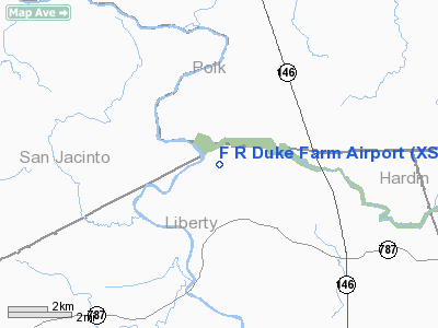
Location & QuickFacts
| FAA Information Effective: | 2008-09-25 |
| Airport Identifier: | XS72 |
| Airport Status: | Operational |
| Longitude/Latitude: | 094-50-00.7450W/30-29-00.7390N
-94.833540/30.483539 (Estimated) |
| Elevation: | 85 ft / 25.91 m (Estimated) |
| Land: | 0 acres |
| From nearest city: | 2 nautical miles N of Romayor, TX |
| Location: | Liberty County, TX |
| Magnetic Variation: | 05E (1985) |
Owner & Manager
| Ownership: | Privately owned |
| Owner: | American Agricultural Service
C/O AMERICAN AGRICULTURAL SERVICE. |
| Address: | 420 Tarrow, Suite 114
College Station, TX 77840 |
| Phone number: | 409-846-0176 |
| Address: |
|
Airport Operations and Facilities
| Airport Use: | Private |
| Wind indicator: | Yes |
| Segmented Circle: | No |
| Control Tower: | No |
| Landing fee charge: | No |
| Sectional chart: | Houston |
| Region: | ASW - Southwest |
| Boundary ARTCC: | ZHU - Houston |
| Tie-in FSS: | CXO - Montgomery County |
| FSS on Airport: | No |
| FSS Toll Free: | 1-800-WX-BRIEF
FOR FP FILING CALL CXO FSS 1-800-833-5602. |
Airport Services
| Airframe Repair: | NONE |
| Power Plant Repair: | NONE |
Runway Information
Runway 02/20
| Dimension: | 3600 x 100 ft / 1097.3 x 30.5 m |
| Surface: | TURF, |
| |
Runway 02 |
Runway 20 |
| Traffic Pattern: | Left | Left |
|
Radio Navigation Aids
| ID |
Type |
Name |
Ch |
Freq |
Var |
Dist |
| HRD | NDB | Hardin County | | 524.00 | 04E | 31.0 nm |
| BVP | NDB | Nixin | | 326.00 | 05E | 35.5 nm |
| GDE | NDB | Goodhue | | 368.00 | 07E | 41.1 nm |
| UTS | NDB | Huntsville | | 308.00 | 06E | 42.1 nm |
| CBC | NDB | Anahuac | | 413.00 | 05E | 43.6 nm |
| DWH | NDB | David Hooks | | 521.00 | 05E | 43.7 nm |
| DAS | VORTAC | Daisetta | 116X | 116.90 | 05E | 20.2 nm |
| LFK | VORTAC | Lufkin | 058X | 112.10 | 05E | 41.2 nm |
| IAH | VORTAC | Humble | 113X | 116.60 | 05E | 41.3 nm |
Remarks
- 4FT FENCE ON EACH SIDE OF RWY.
Images and information placed above are from
http://www.airport-data.com/airport/XS72/
We thank them for the data!
| General Info
|
| Country |
United States
|
| State |
TEXAS
|
| FAA ID |
XS72
|
| Latitude |
30-29-00.739N
|
| Longitude |
094-50-00.745W
|
| Elevation |
85 feet
|
| Near City |
ROMAYOR
|
We don't guarantee the information is fresh and accurate. The data may
be wrong or outdated.
For more up-to-date information please refer to other sources.
|
|


