 |
|
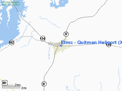
Location & QuickFacts
| FAA Information Effective: | 2008-09-25 |
| Airport Identifier: | XA50 |
| Airport Status: | Operational |
| Longitude/Latitude: | 095-26-39.6000W/32-47-45.6000N
-95.444333/32.796000 (Estimated) |
| Elevation: | 400 ft / 121.92 m (Estimated) |
| Land: | 0 acres |
| From nearest city: | 0 nautical miles E of Quitman, TX |
| Location: | Wood County, TX |
| Magnetic Variation: | () |
Owner & Manager
| Ownership: | Privately owned |
| Owner: | Etmc - Quitman |
| Address: | 117 N. Winnsboro St
Quitman, TX 75783 |
| Phone number: | 903-763-6361 |
| Manager: | Ernir Parisi |
| Address: | 117 N. Winnsboro St.
Quitman, TX 75783 |
| Phone number: | 903-763-6361 |
Airport Operations and Facilities
| Airport Use: | Private
MEDICAL. |
| Wind indicator: | Yes |
| Control Tower: | No |
| Lighting Schedule: | PHONE REQ
FOR FLOOD LGTS CALL 903-763-6361. |
| Sectional chart: | Dallas-ft Worth |
| Region: | ASW - Southwest |
| Boundary ARTCC: | ZFW - Fort Worth |
| Tie-in FSS: | FTW - Fort Worth |
| FSS Phone: | 817-541-3474 |
| FSS Toll Free: | 1-800-WX-BRIEF |
Runway Information
Helipad H1
| Dimension: | 64 x 64 ft / 19.5 x 19.5 m |
| Surface: | CONC, |
| |
Runway H1 |
Runway |
| Traffic Pattern: | Left | Left |
|
Radio Navigation Aids
| ID |
Type |
Name |
Ch |
Freq |
Var |
Dist |
| ABG | NDB | Ambassador | | 404.00 | 07E | 21.0 nm |
| TY | NDB | Tyler | | 320.00 | 06E | 22.9 nm |
| SYW | NDB | Cash | | 428.00 | 05E | 33.4 nm |
| LST | NDB | Lone Star | | 305.00 | 05E | 36.3 nm |
| AVZ | NDB | Travis | | 260.00 | 06E | 40.7 nm |
| AHX | NDB | Athens | | 269.00 | 06E | 43.0 nm |
| MII | NDB | Caddo Mills | | 316.00 | 06E | 43.2 nm |
| HNO | NDB | Henderson | | 371.00 | 06E | 47.0 nm |
| MJF | TACAN | Arvilla | 033X | | 05E | 35.1 nm |
| UIM | VOR/DME | Quitman | 087X | 114.00 | 08E | 6.4 nm |
| SLR | VOR/DME | Sulphur Springs | 027X | 109.00 | 08E | 24.7 nm |
| TYR | VOR/DME | Tyler | 089X | 114.20 | 06E | 26.5 nm |
| FZT | VOR/DME | Frankston | 051X | 111.40 | 06E | 43.6 nm |
| PRX | VOR/DME | Paris | 083X | 113.60 | 07E | 44.9 nm |
| GGG | VORTAC | Gregg County | 070X | 112.30 | 07E | 41.7 nm |
Remarks
- OWNER DESIRES HELIPORT NOT BE CHARTED.
Images and information placed above are from
http://www.airport-data.com/airport/XA50/
We thank them for the data!
|
|


