 |
|
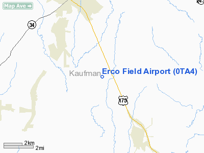
Location & QuickFacts
| FAA Information Effective: | 2008-09-25 |
| Airport Identifier: | 0TA4 |
| Airport Status: | Operational |
| Longitude/Latitude: | 096-16-13.9240W/32-29-52.4970N
-96.270534/32.497916 (Estimated) |
| Elevation: | 395 ft / 120.40 m (Estimated) |
| Land: | 4 acres |
| From nearest city: | 6 nautical miles S of Kaufman, TX |
| Location: | Kaufman County, TX |
| Magnetic Variation: | 06E (1990) |
Owner & Manager
| Ownership: | Privately owned |
| Owner: | William R. Bayne |
| Address: | Rt 5 Box 325
Kaufman, TX 75142-9629 |
| Phone number: | 214-932-5063 |
| Manager: | William R. Bayne |
| Address: | Rt 5 Box 325
Kaufman, TX 75142-9629 |
| Phone number: | 214-932-5063 |
Airport Operations and Facilities
| Airport Use: | Private |
| Segmented Circle: | No |
| Control Tower: | No |
| Sectional chart: | Dallas-ft Worth |
| Region: | ASW - Southwest |
| Boundary ARTCC: | ZFW - Fort Worth |
| Tie-in FSS: | FTW - Fort Worth |
| FSS on Airport: | No |
| FSS Phone: | 817-541-3474 |
| FSS Toll Free: | 1-800-WX-BRIEF |
Runway Information
Runway 15/33
| Dimension: | 1742 x 50 ft / 531.0 x 15.2 m |
| Surface: | TURF, |
| |
Runway 15 |
Runway 33 |
| Traffic Pattern: | Right | Left |
| Displaced threshold: | 100.00 ft | 200.00 ft |
| Obstruction: | 5 ft fence, 100.0 ft from runway | 35 ft pline, 730.0 ft from runway |
|
Radio Navigation Aids
| ID |
Type |
Name |
Ch |
Freq |
Var |
Dist |
| AVZ | NDB | Travis | | 260.00 | 06E | 15.8 nm |
| JUG | NDB | Jecca | | 388.00 | 06E | 16.7 nm |
| PQF | NDB | Mesquite | | 248.00 | 06E | 22.8 nm |
| LNC | NDB | Lancaster | | 239.00 | 06E | 23.4 nm |
| CGQ | NDB | Powell | | 344.00 | 06E | 27.3 nm |
| CRS | NDB | Corsicana | | 396.00 | 06E | 29.0 nm |
| AHX | NDB | Athens | | 269.00 | 06E | 30.2 nm |
| CSZ | NDB | Crossroads | | 215.00 | 08E | 30.6 nm |
| SYW | NDB | Cash | | 428.00 | 05E | 30.9 nm |
| RBD | NDB | Redbird | | 287.00 | 06E | 32.3 nm |
| MII | NDB | Caddo Mills | | 316.00 | 06E | 32.6 nm |
| LIQ | NDB | Lochridge Ranch | | 335.00 | 09E | 33.4 nm |
| XQH | NDB | Cedar Hill | | 353.00 | 08E | 36.2 nm |
| PYF | NDB | Pyramid | | 418.00 | 06E | 38.4 nm |
| TY | NDB | Tyler | | 320.00 | 06E | 40.9 nm |
| MJF | TACAN | Arvilla | 033X | | 05E | 35.8 nm |
| CVE | VOR/DME | Cowboy | 109X | 116.20 | 06E | 39.8 nm |
| TYR | VOR/DME | Tyler | 089X | 114.20 | 06E | 44.8 nm |
| TTT | VOR/DME | Maverick | 078X | 113.10 | 06E | 44.9 nm |
| FZT | VOR/DME | Frankston | 051X | 111.40 | 06E | 45.4 nm |
| CQY | VORTAC | Cedar Creek | 095X | 114.80 | 06E | 19.0 nm |
| DAL | VOT | Dallas Love Field | | 113.30 | | 36.1 nm |
Remarks
- LIVESTOCK ON RY.
- CONSTRUCTION EQUIPMENT PARKED ONE SIDE OF RY.
Images and information placed above are from
http://www.airport-data.com/airport/0TA4/
We thank them for the data!
| General Info
|
| Country |
United States
|
| State |
TEXAS
|
| FAA ID |
0TA4
|
| Latitude |
32-29-52.497N
|
| Longitude |
096-16-13.924W
|
| Elevation |
395 feet
|
| Near City |
KAUFMAN
|
We don't guarantee the information is fresh and accurate. The data may
be wrong or outdated.
For more up-to-date information please refer to other sources.
|
|


