 |
|
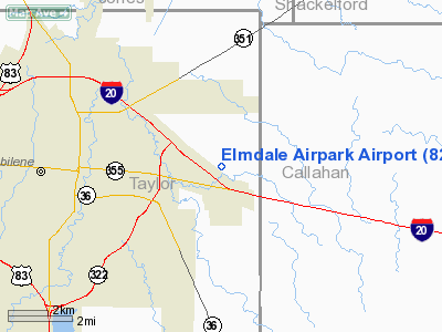
Location & QuickFacts
| FAA Information Effective: | 2008-09-25 |
| Airport Identifier: | 82TS |
| Airport Status: | Operational |
| Longitude/Latitude: | 099-39-01.3090W/32-27-00.4520N
-99.650364/32.450126 (Estimated) |
| Elevation: | 1775 ft / 541.02 m (Estimated) |
| Land: | 59 acres |
| From nearest city: | 5 nautical miles E of Abilene, TX |
| Location: | Taylor County, TX |
| Magnetic Variation: | 08E (1985) |
Owner & Manager
| Ownership: | Privately owned |
| Owner: | Elmdale Airpark Inc |
| Address: | 4682 Newman Rd
Abilene, TX 79604 |
| Phone number: | 325-677-2488 |
| Manager: | Tom Neeb |
| Address: | 4682 Newman Rd
Abilene, TX 79604 |
| Phone number: | 325-677-2488 |
Airport Operations and Facilities
| Airport Use: | Private |
| Wind indicator: | Yes |
| Segmented Circle: | Yes |
| Control Tower: | No |
| Lighting Schedule: | RDO-CTL
ACTVT ROTG BCN - 122.8. |
| Beacon Color: | Clear-Green (lighted land airport)
ROTG BCN OTS INDEFLY. |
| Landing fee charge: | No |
| Sectional chart: | Dallas-ft Worth |
| Region: | ASW - Southwest |
| Traffic Pattern Alt: | 525 ft |
| Boundary ARTCC: | ZFW - Fort Worth |
| Tie-in FSS: | FTW - Fort Worth |
| FSS on Airport: | No |
| FSS Phone: | 817-541-3474 |
| FSS Toll Free: | 1-800-WX-BRIEF |
Airport Services
| Fuel available: | 100LL |
| Airframe Repair: | MAJOR |
| Power Plant Repair: | MAJOR |
Runway Information
Runway 17/35
| Dimension: | 2950 x 30 ft / 899.2 x 9.1 m |
| Surface: | ASPH, Good Condition |
| Weight Limit: | Single wheel: 4000 lbs. |
| Edge Lights: | Low
LIRL OTS INDEFLY. |
| |
Runway 17 |
Runway 35 |
| Traffic Pattern: | Left | Right |
| Displaced threshold: | 180.00 ft | 0.00 ft |
| Centerline Lights: | No | No |
| Obstruction: | 80 ft ant, 1985.0 ft from runway, 20 ft left of centerline, 22:1 slope to clear
APCH SLOPE 27:1 TO DSPLCD THLD FM 80 FT ANT 2165 FT FM THLD 20 FT L. | 30 ft road, 520.0 ft from runway, 10:1 slope to clear |
|
Runway 18/36
| Dimension: | 3270 x 50 ft / 996.7 x 15.2 m |
| Surface: | TURF, Fair Condition |
| |
Runway 18 |
Runway 36 |
| Traffic Pattern: | Left | Right |
| Obstruction: | 80 ft ant, 1817.0 ft from runway, 30 ft right of centerline, 22:1 slope to clear | 30 ft road, 455.0 ft from runway, 15:1 slope to clear |
|
Radio Navigation Aids
| ID |
Type |
Name |
Ch |
Freq |
Var |
Dist |
| TMV | NDB | Stamford | | 290.00 | 08E | 25.5 nm |
| IEW | NDB | Winters | | 396.00 | 08E | 34.8 nm |
| COM | NDB | Coleman | | 385.00 | 07E | 38.7 nm |
| SWW | NDB | Sweetwater | | 275.00 | 08E | 41.4 nm |
| BKD | NDB | Breckenridge | | 245.00 | 07E | 42.4 nm |
| OIP | NDB | Old Rip | | 410.00 | 07E | 42.7 nm |
| AKL | NDB | Haskell | | 407.00 | 08E | 44.7 nm |
| UBC | NDB | Ballinger | | 239.00 | 08E | 49.1 nm |
| DYS | TACAN | Dyess | 063X | | 08E | 10.7 nm |
| TQA | VOR/DME | Tuscola | 053X | 111.60 | 10E | 15.4 nm |
| BWD | VOR/DME | Brownwood | 023X | 108.60 | 08E | 48.6 nm |
| ABI | VORTAC | Abilene | 084X | 113.70 | 10E | 11.0 nm |
Remarks
- STRAIGHT-IN APCHS NOT RECOMMENDED.
- PAEW ON ARPT.
- RGT TFC PTN RWY 35.ALT 400 FT OR LOWER UNLESS AUTHZD BY ABI RAPCON/TWR-ARPT MGR TO ESTBLH OPRN RDO CTC PROCEDURES FOR ELMDALE/ABI.
Images and information placed above are from
http://www.airport-data.com/airport/82TS/
We thank them for the data!
| General Info
|
| Country |
United States
|
| State |
TEXAS
|
| FAA ID |
82TS
|
| Latitude |
33-16-55.418N
|
| Longitude |
097-29-49.092W
|
| Elevation |
923 feet
|
| Near City |
DECATUR
|
We don't guarantee the information is fresh and accurate. The data may
be wrong or outdated.
For more up-to-date information please refer to other sources.
|
|


