 |
|
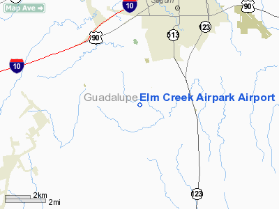
Elm Creek Airpark Airport |
Location & QuickFacts
| FAA Information Effective: | 2008-09-25 |
| Airport Identifier: | 0TX6 |
| Airport Status: | Operational |
| Longitude/Latitude: | 097-59-49.0180W/29-30-18.8350N
-97.996949/29.505232 (Estimated) |
| Elevation: | 550 ft / 167.64 m (Estimated) |
| Land: | 58 acres |
| From nearest city: | 4 nautical miles SS of Seguin, TX |
| Location: | Guadalupe County, TX |
| Magnetic Variation: | 07E (1985) |
Owner & Manager
| Ownership: | Privately owned |
| Owner: | Elm Creek Homeowners Assn Inc |
| Address: | 100 Tailwind Drive
Seguin, TX 78155-0791 |
| Phone number: | 830-303-1462 |
| Manager: | Elm Creek Homeowners Assn Inc |
| Address: | 100 Tailwind Drive
Seguin, TX 78155-0791 |
| Phone number: | 830-303-1462 |
Airport Operations and Facilities
| Airport Use: | Private |
| Wind indicator: | Yes |
| Segmented Circle: | No |
| Control Tower: | No |
| Landing fee charge: | No |
| Sectional chart: | San Antonio |
| Region: | ASW - Southwest |
| Boundary ARTCC: | ZHU - Houston |
| Tie-in FSS: | SJT - San Angelo |
| FSS on Airport: | No |
| FSS Toll Free: | 1-800-WX-BRIEF |
Runway Information
Runway 14/32
| Dimension: | 2283 x 80 ft / 695.9 x 24.4 m |
| Surface: | TURF, |
| |
Runway 14 |
Runway 32 |
| Traffic Pattern: | Left | Right |
| Obstruction: | 20 ft pline, 500.0 ft from runway | |
|
Radio Navigation Aids
| ID |
Type |
Name |
Ch |
Freq |
Var |
Dist |
| PEZ | NDB | Pleasanton | | 275.00 | 07E | 42.9 nm |
| CVB | NDB | Castroville | | 338.00 | 08E | 45.6 nm |
| OKT | NDB | Yoakum | | 350.00 | 06E | 46.4 nm |
| DHK | TACAN | Randolph | 036X | | 09E | 14.3 nm |
| KSY | TACAN | Kelly | 057X | | 07E | 31.3 nm |
| SSF | VOR | Stinson | | 108.40 | 09E | 27.7 nm |
| RND | VORTAC | Randolph | 70X | 112.30 | 09E | 15.1 nm |
| SAT | VORTAC | San Antonio | 115X | 116.80 | 08E | 25.7 nm |
| SAT | VOT | San Antonio Intl | | 110.40 | | 24.8 nm |
Remarks
- DUE TO INTERACTION BETWEEN AIRCRAFT OPERATING AT ELM CREEK ARPT AND MILITARY OPERATIONS IN THE AREA.
Images and information placed above are from
http://www.airport-data.com/airport/0TX6/
We thank them for the data!
| General Info
|
| Country |
United States
|
| State |
TEXAS
|
| FAA ID |
0TX6
|
| Latitude |
29-30-18.835N
|
| Longitude |
097-59-49.018W
|
| Elevation |
550 feet
|
| Near City |
SEGUIN
|
We don't guarantee the information is fresh and accurate. The data may
be wrong or outdated.
For more up-to-date information please refer to other sources.
|
|


