 |
|
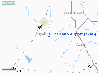
Location & QuickFacts
| FAA Information Effective: | 2008-09-25 |
| Airport Identifier: | 72XS |
| Airport Status: | Operational |
| Longitude/Latitude: | 096-41-04.9110W/30-02-00.7960N
-96.684698/30.033554 (Estimated) |
| Elevation: | 340 ft / 103.63 m (Estimated) |
| Land: | 0 acres |
| From nearest city: | 2 nautical miles SE of Round Top, TX |
| Location: | Fayette County, TX |
| Magnetic Variation: | 06E (1985) |
Owner & Manager
| Ownership: | Privately owned |
| Owner: | O.g. Schatte |
| Address: | Box 7
Round Top, TX 78954 |
| Phone number: | 409-249-3699 |
| Manager: | O. G. Schatte |
| Address: | Box 7
Round Top, TX 78954 |
| Phone number: | 409-249-3699 |
Airport Operations and Facilities
| Airport Use: | Private |
| Wind indicator: | Yes |
| Segmented Circle: | No |
| Control Tower: | No |
| Landing fee charge: | No |
| Sectional chart: | Houston |
| Region: | ASW - Southwest |
| Boundary ARTCC: | ZHU - Houston |
| Tie-in FSS: | CXO - Montgomery County |
| FSS on Airport: | No |
| FSS Toll Free: | 1-800-WX-BRIEF
FOR FP FILING CALL CXO FSS 1-800-833-5602. |
Airport Communications
Airport Services
| Airframe Repair: | MAJOR |
| Power Plant Repair: | MAJOR |
| Bottled Oxygen: | NONE |
| Bulk Oxygen: | NONE |
Runway Information
Runway 02/20
| Dimension: | 1750 x 50 ft / 533.4 x 15.2 m |
| Surface: | TURF, |
| |
Runway 02 |
Runway 20 |
| Traffic Pattern: | Left | Left |
| Obstruction: | 4 ft fence | 35 ft trees, 0.0 ft from runway
+30' TREES 75' RIGHT OF CNTRLN AT THR. |
|
Runway 08/26
| Dimension: | 1900 x 50 ft / 579.1 x 15.2 m |
| Surface: | TURF, |
| |
Runway 08 |
Runway 26 |
| Traffic Pattern: | Left | Left |
| Obstruction: | 4 ft fence | 10 ft trees, 0.0 ft from runway |
|
Radio Navigation Aids
| ID |
Type |
Name |
Ch |
Freq |
Var |
Dist |
| GYB | NDB | Lee County | | 385.00 | 07E | 17.3 nm |
| BNH | NDB | Brenham | | 362.00 | 06E | 19.8 nm |
| OKT | NDB | Yoakum | | 350.00 | 06E | 49.4 nm |
| ELA | VOR/DME | Eagle Lake | 111X | 116.40 | 08E | 29.4 nm |
| IDU | VORTAC | Industry | 039X | 110.20 | 08E | 7.9 nm |
| TNV | VORTAC | Navasota | 106X | 115.90 | 08E | 36.0 nm |
| CLL | VORTAC | College Station | 080X | 113.30 | 08E | 37.0 nm |
| CWK | VORTAC | Centex | 075X | 112.80 | 06E | 48.6 nm |
Remarks
- RWYS SOFT WHEN WET.
- HANGAR AND TIE DOWNS AVBL.
Images and information placed above are from
http://www.airport-data.com/airport/72XS/
We thank them for the data!
| General Info
|
| Country |
United States
|
| State |
TEXAS
|
| FAA ID |
72XS
|
| Latitude |
30-02-00.796N
|
| Longitude |
096-41-04.911W
|
| Elevation |
340 feet
|
| Near City |
ROUND TOP
|
We don't guarantee the information is fresh and accurate. The data may
be wrong or outdated.
For more up-to-date information please refer to other sources.
|
|


