 |
|
Location & QuickFacts
| FAA Information Effective: | 2008-09-25 |
| Airport Identifier: | 2TA8 |
| Airport Status: | Operational |
| Longitude/Latitude: | 098-13-19.0260W/26-51-30.1890N
-98.221952/26.858386 (Estimated) |
| Elevation: | 196 ft / 59.74 m (Estimated) |
| Land: | 52 acres |
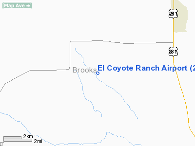
| From nearest city: | 8 nautical miles W of Encino, TX |
| Location: | Brooks County, TX |
| Magnetic Variation: | 07E (1995) |
Owner & Manager
| Ownership: | Privately owned |
| Owner: | Lee M Bass |
| Address: | 201 Main Street
Fort Worth, TX 76102 |
| Phone number: | 817-625-1611 |
| Manager: | John Mc Curdy |
| Address: | 3800 Lincoln Avenue
Fort Worth, TX 76106 |
| Phone number: | 817-625-1611 |
Airport Operations and Facilities
| Airport Use: | Private |
| Segmented Circle: | No |
| Control Tower: | No |
| Lighting Schedule: | PHONE REQ
FOR HIRL RY 13/31 CALL 817-625-1611. |
| Sectional chart: | Brownsville |
| Region: | ASW - Southwest |
| Boundary ARTCC: | ZHU - Houston |
| Tie-in FSS: | SJT - San Angelo |
| FSS on Airport: | No |
| FSS Toll Free: | 1-800-WX-BRIEF |
Runway Information
Runway 13/31
| Dimension: | 5500 x 75 ft / 1676.4 x 22.9 m |
| Surface: | ASPH, |
| Edge Lights: | High |
| |
Runway 13 |
Runway 31 |
| Longitude: | 098-13-42.3200W | 098-12-57.3300W |
| Latitude: | 26-51-51.5700N | 26-51-14.9800N |
| Elevation: | 196.00 ft | 173.00 ft |
| Traffic Pattern: | Left | Left |
| Markings: | Non-precision instrument, | Non-precision instrument, |
|
Radio Navigation Aids
| ID |
Type |
Name |
Ch |
Freq |
Var |
Dist |
| SNE | NDB | Santa Elena | | 260.00 | 07E | 20.8 nm |
| BKS | NDB | Brooks County | | 353.00 | 06E | 21.6 nm |
| HBV | NDB | Hebbronville | | 266.00 | 06E | 40.8 nm |
| TKB | NDB | Kleberg County | | 347.00 | 06E | 45.5 nm |
| NQI | TACAN | Kingsville | 125X | | 09E | 44.5 nm |
| MFE | VOR/DME | Mc Allen | 119X | 117.20 | 09E | 41.2 nm |
| HRL | VOR/DME | Harlingen | 029X | 109.20 | 05E | 48.7 nm |
Images and information placed above are from
http://www.airport-data.com/airport/2TA8/
We thank them for the data!
| General Info
|
| Country |
United States
|
| State |
TEXAS
|
| FAA ID |
2TA8
|
| Latitude |
26-51-30.189N
|
| Longitude |
098-13-19.026W
|
| Elevation |
183 feet
|
| Near City |
ENCINO
|
We don't guarantee the information is fresh and accurate. The data may
be wrong or outdated.
For more up-to-date information please refer to other sources.
|
|


