 |
|
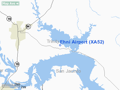
Location & QuickFacts
| FAA Information Effective: | 2008-09-25 |
| Airport Identifier: | XA52 |
| Airport Status: | Operational |
| Longitude/Latitude: | 095-17-36.6000W/30-55-24.7000N
-95.293500/30.923528 (Estimated) |
| Elevation: | 225 ft / 68.58 m (Estimated) |
| Land: | 125 acres |
| From nearest city: | 5 nautical miles SE of Trinity, TX |
| Location: | Trinity County, TX |
| Magnetic Variation: | () |
Owner & Manager
| Ownership: | Privately owned |
| Owner: | Dallas & Scott Ehni |
| Address: | 740 Grand Rock Point Drive
Trinity, TX 75862 |
| Phone number: | 936-594-5525 |
| Manager: | Dallas Ehni |
| Address: | 740 Grand Rock Point Drive
Trinity, TX 75862 |
| Phone number: | 936-594-5525 |
Airport Operations and Facilities
| Airport Use: | Private |
| Wind indicator: | Yes |
| Control Tower: | No |
| Sectional chart: | Houston |
| Region: | ASW - Southwest |
| Boundary ARTCC: | ZHU - Houston |
| Tie-in FSS: | CXO - Montgomery County |
| FSS Toll Free: | 1-800-WX-BRIEF |
Airport Services
| Fuel available: | 100LLA
FOR FUEL CALL 936-594-5525. |
Runway Information
Runway 18/36
| Dimension: | 3000 x 50 ft / 914.4 x 15.2 m |
| Surface: | TURF, |
| |
Runway 18 |
Runway 36 |
| Traffic Pattern: | Left | Left |
| Displaced threshold: | 0.00 ft | 1000.00 ft |
| Obstruction: | | 100 ft trees, 0.0 ft from runway |
|
Radio Navigation Aids
| ID |
Type |
Name |
Ch |
Freq |
Var |
Dist |
| UTS | NDB | Huntsville | | 308.00 | 06E | 18.9 nm |
| OC | NDB | Nados | | 253.00 | 05E | 44.8 nm |
| DWH | NDB | David Hooks | | 521.00 | 05E | 50.0 nm |
| LFK | VORTAC | Lufkin | 058X | 112.10 | 05E | 33.0 nm |
| LOA | VORTAC | Leona | 045X | 110.80 | 08E | 36.8 nm |
Remarks
Images and information placed above are from
http://www.airport-data.com/airport/XA52/
We thank them for the data!
|
|


