 |
|
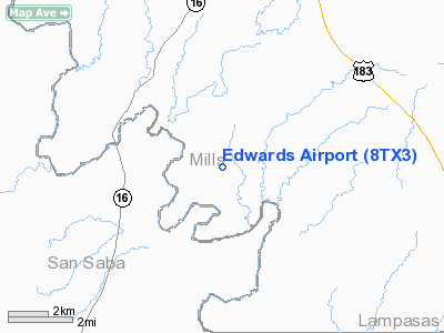
Location & QuickFacts
| FAA Information Effective: | 2008-09-25 |
| Airport Identifier: | 8TX3 |
| Airport Status: | Operational |
| Longitude/Latitude: | 098-36-56.1520W/31-20-34.5950N
-98.615598/31.342943 (Estimated) |
| Elevation: | 1300 ft / 396.24 m (Estimated) |
| Land: | 71 acres |
| From nearest city: | 8 nautical miles SW of Goldthwaite, TX |
| Location: | Mills County, TX |
| Magnetic Variation: | 08E (1985) |
Owner & Manager
| Ownership: | Privately owned |
| Owner: | Gene H. Edwards |
| Address: | 623 S. Henderson
Ft Worth, TX 76104 |
| Phone number: | 817-332-4338 |
| Address: |
|
| Phone number: | 915-938-5295 |
Airport Operations and Facilities
| Airport Use: | Private |
| Wind indicator: | Yes |
| Segmented Circle: | No |
| Control Tower: | No |
| Sectional chart: | San Antonio |
| Region: | ASW - Southwest |
| Boundary ARTCC: | ZHU - Houston |
| Tie-in FSS: | FTW - Fort Worth |
| FSS on Airport: | No |
| FSS Phone: | 817-541-3474 |
| FSS Toll Free: | 1-800-WX-BRIEF |
Runway Information
Runway 09/27
| Dimension: | 1350 x 110 ft / 411.5 x 33.5 m |
| Surface: | TURF, |
| |
Runway 09 |
Runway 27 |
| Traffic Pattern: | Left | Left |
| Displaced threshold: | 260.00 ft | 400.00 ft |
| Obstruction: | | 12 ft tower, 260.0 ft from runway |
|
Runway 17/35
| Dimension: | 1550 x 100 ft / 472.4 x 30.5 m |
| Surface: | TURF, |
| |
Runway 17 |
Runway 35 |
| Traffic Pattern: | Left | Left |
| Displaced threshold: | 275.00 ft | 250.00 ft |
|
Radio Navigation Aids
| ID |
Type |
Name |
Ch |
Freq |
Var |
Dist |
| MNZ | NDB | Hamilton | | 251.00 | 07E | 29.2 nm |
| BBD | NDB | Brady | | 380.00 | 07E | 37.7 nm |
| GR | NDB | Starn | | 323.00 | 07E | 39.3 nm |
| BMQ | NDB | Burnet | | 341.00 | 07E | 41.2 nm |
| HLR | NDB | Hood | | 347.00 | 07E | 48.2 nm |
| BWD | VOR/DME | Brownwood | 023X | 108.60 | 08E | 37.4 nm |
| GRK | VOR/DME | Gray | 055X | 111.80 | 07E | 45.2 nm |
| LZZ | VORTAC | Lampasas | 072X | 112.50 | 08E | 26.1 nm |
| LLO | VORTAC | Llano | 019X | 108.20 | 08E | 34.0 nm |
Images and information placed above are from
http://www.airport-data.com/airport/8TX3/
We thank them for the data!
| General Info
|
| Country |
United States
|
| State |
TEXAS
|
| FAA ID |
8TX3
|
| Latitude |
31-20-34.595N
|
| Longitude |
098-36-56.152W
|
| Elevation |
1300 feet
|
| Near City |
GOLDTHWAITE
|
We don't guarantee the information is fresh and accurate. The data may
be wrong or outdated.
For more up-to-date information please refer to other sources.
|
|


