 |
|
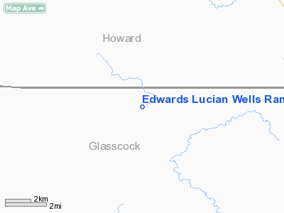
Edwards Lucian Wells Ranch Airport |
Location & QuickFacts
| FAA Information Effective: | 2008-09-25 |
| Airport Identifier: | TX31 |
| Airport Status: | Operational |
| Longitude/Latitude: | 101-33-51.4480W/32-04-25.4540N
-101.564291/32.073737 (Estimated) |
| Elevation: | 2505 ft / 763.52 m (Estimated) |
| Land: | 0 acres |
| From nearest city: | 11 nautical miles SW of Big Spring, TX |
| Location: | Glasscock County, TX |
| Magnetic Variation: | 09E (1985) |
Owner & Manager
| Ownership: | Privately owned |
| Owner: | Wilson C Edwards |
| Address: | Box 2431
Big Spring, TX 79720 |
| Phone number: | 915-398-5470 |
| Address: |
|
Airport Operations and Facilities
| Airport Use: | Private |
| Wind indicator: | Yes |
| Segmented Circle: | No |
| Control Tower: | No |
| Lighting Schedule: | RDO-CTL
FOR LIRL & RTG BCN KEY 122.85 5 TIMES. |
| Beacon Color: | Clear-Green (lighted land airport) |
| Landing fee charge: | No |
| Sectional chart: | Dallas-ft Worth |
| Region: | ASW - Southwest |
| Boundary ARTCC: | ZFW - Fort Worth |
| Tie-in FSS: | SJT - San Angelo |
| FSS on Airport: | No |
| FSS Toll Free: | 1-800-WX-BRIEF |
Airport Services
| Airframe Repair: | NONE |
| Power Plant Repair: | NONE |
Runway Information
Runway 02/20
| Dimension: | 5200 x 100 ft / 1585.0 x 30.5 m |
| Surface: | ASPH, |
| Edge Lights: | Low |
| |
Runway 02 |
Runway 20 |
| Traffic Pattern: | Left | Left |
|
Radio Navigation Aids
| ID |
Type |
Name |
Ch |
Freq |
Var |
Dist |
| MA | NDB | Farly | | 326.00 | 09E | 39.1 nm |
| LSA | NDB | Lamesa | | 338.00 | 09E | 44.9 nm |
| SDR | NDB | Snyder | | 359.00 | 08E | 49.1 nm |
| BGS | VORTAC | Big Spring | 090X | 114.30 | 11E | 19.2 nm |
| MAF | VORTAC | Midland | 095X | 114.80 | 11E | 32.1 nm |
| MAF | VOT | Midland International | | 108.20 | | 33.8 nm |
Images and information placed above are from
http://www.airport-data.com/airport/TX31/
We thank them for the data!
| General Info
|
| Country |
United States
|
| State |
TEXAS
|
| FAA ID |
TX31
|
| Latitude |
32-04-25.454N
|
| Longitude |
101-33-51.448W
|
| Elevation |
2505 feet
|
| Near City |
BIG SPRING
|
We don't guarantee the information is fresh and accurate. The data may
be wrong or outdated.
For more up-to-date information please refer to other sources.
|
|


