 |
|
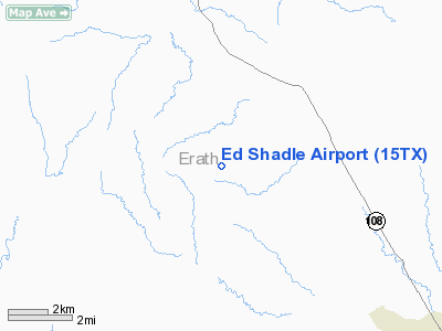
Location & QuickFacts
| FAA Information Effective: | 2008-09-25 |
| Airport Identifier: | 15TX |
| Airport Status: | Operational |
| Longitude/Latitude: | 098-19-31.1640W/32-18-15.4930N
-98.325323/32.304304 (Estimated) |
| Elevation: | 1550 ft / 472.44 m (Estimated) |
| Land: | 0 acres |
| From nearest city: | 8 nautical miles N of Stephenville, TX |
| Location: | Erath County, TX |
| Magnetic Variation: | 07E (1985) |
Owner & Manager
| Ownership: | Privately owned |
| Owner: | Marsha Louise Tompkins |
| Address: | 201 Casas Del Sur St
Granbury, TX 76049 |
| Phone number: | 817-279-7649 |
| Manager: | Charles A. Tompkins Jr |
| Address: | 106 Auriel Circle
Maumelle, AR 72113 |
| Phone number: | 501-803-9777 |
Airport Operations and Facilities
| Airport Use: | Private |
| Wind indicator: | Yes
WINDMILL |
| Segmented Circle: | No |
| Control Tower: | No |
| Landing fee charge: | No |
| Sectional chart: | Dallas-ft Worth |
| Region: | ASW - Southwest |
| Boundary ARTCC: | ZFW - Fort Worth |
| Tie-in FSS: | FTW - Fort Worth |
| FSS on Airport: | No |
| FSS Phone: | 817-541-3474 |
| FSS Toll Free: | 1-800-WX-BRIEF |
Airport Services
| Airframe Repair: | NONE |
| Power Plant Repair: | NONE |
Runway Information
Runway 17/35
| Dimension: | 1550 x 50 ft / 472.4 x 15.2 m |
| Surface: | TURF, |
| |
Runway 17 |
Runway 35 |
| Traffic Pattern: | Left | Left |
|
Radio Navigation Aids
| ID |
Type |
Name |
Ch |
Freq |
Var |
Dist |
| OIP | NDB | Old Rip | | 410.00 | 07E | 25.3 nm |
| MWL | NDB | Mineral Wells | | 266.00 | 06E | 31.9 nm |
| BKD | NDB | Breckenridge | | 245.00 | 07E | 39.1 nm |
| GZV | NDB | Brazos River | | 280.00 | 07E | 39.2 nm |
| MNZ | NDB | Hamilton | | 251.00 | 07E | 42.1 nm |
| BWD | VOR/DME | Brownwood | 023X | 108.60 | 08E | 40.6 nm |
| JEN | VORTAC | Glen Rose | 097X | 115.00 | 06E | 24.4 nm |
| MQP | VORTAC | Millsap | 124X | 117.70 | 09E | 30.3 nm |
Images and information placed above are from
http://www.airport-data.com/airport/15TX/
We thank them for the data!
| General Info
|
| Country |
United States
|
| State |
TEXAS
|
| FAA ID |
15TX
|
| Latitude |
32-18-15.493N
|
| Longitude |
098-19-31.164W
|
| Elevation |
1550 feet
|
| Near City |
STEPHENVILLE
|
We don't guarantee the information is fresh and accurate. The data may
be wrong or outdated.
For more up-to-date information please refer to other sources.
|
|


