 |
|
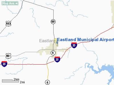
Location & QuickFacts
| FAA Information Effective: | 2008-09-25 |
| Airport Identifier: | ETN |
| Airport Status: | Operational |
| Longitude/Latitude: | 098-48-35.1240W/32-24-48.5700N
-98.809757/32.413492 (Estimated) |
| Elevation: | 1464 ft / 446.23 m (Surveyed) |
| Land: | 207 acres |
| From nearest city: | 1 nautical miles N of Eastland, TX |
| Location: | Eastland County, TX |
| Magnetic Variation: | 07E (1995) |
Owner & Manager
| Ownership: | Publicly owned |
| Owner: | City Of Eastland |
| Address: | Po Box 749
Eastland, TX 76448 |
| Phone number: | 254-629-8321 |
| Manager: | Bode Zietz |
| Address: | Po Box 47
Eastland, TX 76448 |
| Phone number: | 254-629-1588
OR 254-488-1055 |
Airport Operations and Facilities
| Airport Use: | Open to public |
| Wind indicator: | Yes |
| Segmented Circle: | Yes |
| Control Tower: | No |
| Lighting Schedule: | DUSK-DAWN
ACTVT MIRL RY 17/35 & PAPI RYS 17 & 35 - CTAF. |
| Beacon Color: | Clear-Green (lighted land airport) |
| Landing fee charge: | No |
| Sectional chart: | Dallas-ft Worth |
| Region: | ASW - Southwest |
| Boundary ARTCC: | ZFW - Fort Worth |
| Tie-in FSS: | FTW - Fort Worth |
| FSS on Airport: | No |
| FSS Phone: | 817-541-3474 |
| FSS Toll Free: | 1-800-WX-BRIEF |
| NOTAMs Facility: | FTW (NOTAM-d service avaliable) |
| Federal Agreements: | N |
Airport Communications
| CTAF: | 122.800 |
| Unicom: | 122.800 |
Airport Services
| Fuel available: | 100LLA
FOR FUEL AFT HRS CALL 254-488-1055. SELF-SERVE FUEL AVBL 24 HRS WITH MAJOR CREDIT CARDS. |
| Airframe Repair: | MAJOR |
| Power Plant Repair: | MINOR |
| Bottled Oxygen: | HIGH |
| Bulk Oxygen: | NONE |
Runway Information
Runway 17/35
| Dimension: | 4020 x 60 ft / 1225.3 x 18.3 m |
| Surface: | ASPH, Good Condition |
| Weight Limit: | Single wheel: 20000 lbs. |
| Edge Lights: | Medium |
| |
Runway 17 |
Runway 35 |
| Longitude: | 098-48-34.3500W | 098-48-35.8455W |
| Latitude: | 32-25-08.6328N | 32-24-28.8757N |
| Elevation: | 1464.00 ft | 1445.00 ft |
| Alignment: | 127 | 2 |
| Traffic Pattern: | Left | Left |
| Markings: | Non-precision instrument, Fair Condition | Non-precision instrument, Fair Condition |
| Crossing Height: | 54.00 ft | 45.00 ft |
| VASI: | 2-light PAPI on left side | 2-light PAPI on left side |
| Visual Glide Angle: | 3.50° | 3.00° |
| Obstruction: | 88 ft trees, 2400.0 ft from runway, 25:1 slope to clear | 30 ft pline, 638.0 ft from runway, 271 ft right of centerline, 14:1 slope to clear |
|
Radio Navigation Aids
| ID |
Type |
Name |
Ch |
Freq |
Var |
Dist |
| OIP | NDB | Old Rip | | 410.00 | 07E | 0.9 nm |
| BKD | NDB | Breckenridge | | 245.00 | 07E | 20.5 nm |
| GZV | NDB | Brazos River | | 280.00 | 07E | 38.1 nm |
| MWL | NDB | Mineral Wells | | 266.00 | 06E | 44.2 nm |
| COM | NDB | Coleman | | 385.00 | 07E | 45.9 nm |
| GHX | NDB | Graham | | 371.00 | 07E | 47.9 nm |
| BWD | VOR/DME | Brownwood | 023X | 108.60 | 08E | 32.2 nm |
| MQP | VORTAC | Millsap | 124X | 117.70 | 09E | 45.2 nm |
| JEN | VORTAC | Glen Rose | 097X | 115.00 | 06E | 49.8 nm |
Images and information placed above are from
http://www.airport-data.com/airport/ETN/
We thank them for the data!
| General Info
|
| Country |
United States
|
| State |
TEXAS
|
| FAA ID |
ETN
|
| Latitude |
32-24-48.570N
|
| Longitude |
098-48-35.124W
|
| Elevation |
1464 feet
|
| Near City |
EASTLAND
|
We don't guarantee the information is fresh and accurate. The data may
be wrong or outdated.
For more up-to-date information please refer to other sources.
|
|


