 |
|
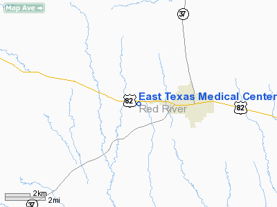
East Texas Medical Center Clarksville Heliport |
Location & QuickFacts
| FAA Information Effective: | 2008-09-25 |
| Airport Identifier: | 23XA |
| Airport Status: | Operational |
| Longitude/Latitude: | 095-05-56.8500W/33-36-39.5400N
-95.099125/33.610983 (Estimated) |
| Elevation: | 413 ft / 125.88 m (Estimated) |
| Land: | 0 acres |
| From nearest city: | 3 nautical miles W of Clarksville, TX |
| Location: | Red River County, TX |
| Magnetic Variation: | () |
Owner & Manager
| Ownership: | Privately owned |
| Owner: | Red River Hospital Authority |
| Address: | 3000 Hwy 82 West
Clarksville, TX 75426 |
| Phone number: | 903-427-6400 |
| Manager: | Cecil Loftin |
| Address: | 3000 Hwy 82 West
Clarksville, TX 75426 |
| Phone number: | 903-427-6400 |
Airport Operations and Facilities
| Airport Use: | Private
MEDICAL USE. |
| Wind indicator: | Yes |
| Control Tower: | No |
| Lighting Schedule: | DUSK-DAWN |
| Sectional chart: | Dallas-ft Worth |
| Region: | ASW - Southwest |
| Boundary ARTCC: | ZFW - Fort Worth |
| Tie-in FSS: | FTW - Fort Worth |
| FSS Phone: | 817-541-3474 |
| FSS Toll Free: | 1-800-WX-BRIEF |
Runway Information
Helipad H1
| Dimension: | 30 x 30 ft / 9.1 x 9.1 m |
| Surface: | CONC, |
| |
Runway H1 |
Runway |
| Traffic Pattern: | Left | Left |
|
Radio Navigation Aids
| ID |
Type |
Name |
Ch |
Freq |
Var |
Dist |
| IBO | NDB | Idabel | | 271.00 | 03E | 21.9 nm |
| HHW | NDB | Hugo | | 323.00 | 05E | 33.9 nm |
| DEQ | NDB | De Queen | | 281.00 | 04E | 43.6 nm |
| AEE | NDB | Antlers | | 391.00 | 05E | 44.5 nm |
| LST | NDB | Lone Star | | 305.00 | 05E | 44.8 nm |
| PRX | VOR/DME | Paris | 083X | 113.60 | 07E | 18.0 nm |
| SLR | VOR/DME | Sulphur Springs | 027X | 109.00 | 08E | 33.3 nm |
| UIM | VOR/DME | Quitman | 087X | 114.00 | 08E | 45.9 nm |
Images and information placed above are from
http://www.airport-data.com/airport/23XA/
We thank them for the data!
|
|


