 |
|
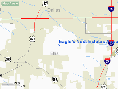
Eagle's Nest Estates Airport |
Location & QuickFacts
| FAA Information Effective: | 2008-09-25 |
| Airport Identifier: | 2TS6 |
| Airport Status: | Operational |
| Longitude/Latitude: | 096-55-36.0080W/32-30-45.4960N
-96.926669/32.512638 (Estimated) |
| Elevation: | 780 ft / 237.74 m (Estimated) |
| Land: | 30 acres |
| From nearest city: | 3 nautical miles S of Midlothian, TX |
| Location: | Ellis County, TX |
| Magnetic Variation: | 06E (1985) |
Owner & Manager
| Ownership: | Privately owned |
| Owner: | Eagles Nest Property Owners
ASSOCIATION. |
| Address: | Po Box 8
Midlothian, TX 76065 |
| Phone number: | 214-723-2299 |
| Manager: | Bryan Pender
PRESIDENT. |
| Address: | 2551 N. Mockingbird Lane
Midlothian, TX 76065 |
| Phone number: | 972-775-1067 |
Airport Operations and Facilities
| Airport Use: | Private |
| Wind indicator: | Yes |
| Segmented Circle: | No |
| Control Tower: | No |
| Lighting Schedule: | RDO-CTL
ACTVT MIRL RY 17/35 - 122.975. |
| Sectional chart: | Dallas-ft Worth |
| Region: | ASW - Southwest |
| Boundary ARTCC: | ZFW - Fort Worth |
| Tie-in FSS: | FTW - Fort Worth |
| FSS Phone: | 817-541-3474 |
| FSS Toll Free: | 1-800-WX-BRIEF |
Runway Information
Runway 17/35
| Dimension: | 3200 x 36 ft / 975.4 x 11.0 m |
| Surface: | CONC, |
| Edge Lights: | Medium
STROBES MARK THRS. |
| |
Runway 17 |
Runway 35 |
| Traffic Pattern: | Left | Right |
| Markings: | Basic, | Basic, |
| Displaced threshold: | 350.00 ft | 420.00 ft |
| Obstruction: | 16 ft pline, 50.0 ft from runway | 30 ft trees, 100.0 ft from runway |
|
Radio Navigation Aids
| ID |
Type |
Name |
Ch |
Freq |
Var |
Dist |
| XQH | NDB | Cedar Hill | | 353.00 | 08E | 5.4 nm |
| RBD | NDB | Redbird | | 287.00 | 06E | 10.3 nm |
| LNC | NDB | Lancaster | | 239.00 | 06E | 11.1 nm |
| JUG | NDB | Jecca | | 388.00 | 06E | 22.1 nm |
| PQF | NDB | Mesquite | | 248.00 | 06E | 26.9 nm |
| CGQ | NDB | Powell | | 344.00 | 06E | 37.0 nm |
| AVZ | NDB | Travis | | 260.00 | 06E | 37.4 nm |
| CRS | NDB | Corsicana | | 396.00 | 06E | 39.7 nm |
| MII | NDB | Caddo Mills | | 316.00 | 06E | 46.7 nm |
| NFW | TACAN | Nas Jrb Fort Worth | 024X | | 07E | 30.3 nm |
| TTT | VOR/DME | Maverick | 078X | 113.10 | 06E | 22.2 nm |
| CVE | VOR/DME | Cowboy | 109X | 116.20 | 06E | 22.7 nm |
| FUZ | VORTAC | Ranger | 104X | 115.70 | 06E | 26.0 nm |
| CQY | VORTAC | Cedar Creek | 095X | 114.80 | 06E | 41.0 nm |
| DAL | VOT | Dallas Love Field | | 113.30 | | 20.5 nm |
| FTW | VOT | Fort Worth Meacham | | 108.20 | | 28.5 nm |
Images and information placed above are from
http://www.airport-data.com/airport/2TS6/
We thank them for the data!
| General Info
|
| Country |
United States
|
| State |
TEXAS
|
| FAA ID |
2TS6
|
| Latitude |
32-30-45.496N
|
| Longitude |
096-55-36.008W
|
| Elevation |
780 feet
|
| Near City |
MIDLOTHIAN
|
We don't guarantee the information is fresh and accurate. The data may
be wrong or outdated.
For more up-to-date information please refer to other sources.
|
|


