 |
|
Location & QuickFacts
| FAA Information Effective: | 2008-09-25 |
| Airport Identifier: | 55T |
| Airport Status: | Operational |
| Longitude/Latitude: | 101-24-38.8000W/35-12-56.2000N
-101.410778/35.215611 (Estimated) |
| Elevation: | 3475 ft / 1059.18 m (Estimated) |
| Land: | 100 acres |
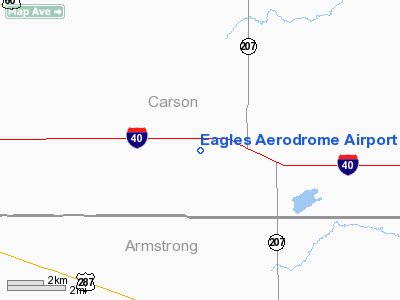
| From nearest city: | 2 nautical miles W of Conway, TX |
| Location: | Carson County, TX |
| Magnetic Variation: | 09E (1985) |
Owner & Manager
| Ownership: | Privately owned |
| Owner: | Jerry P. Parker |
| Address: | Po Box 1419
Panhandle, TX 79068 |
| Phone number: | 806-674-3335 |
| Manager: | Jerry P. Parker |
| Address: | Po Box 1419
Panhandle, TX 79068 |
| Phone number: | 806-674-3335 |
Airport Operations and Facilities
| Airport Use: | Open to public |
| Wind indicator: | Yes |
| Segmented Circle: | No |
| Control Tower: | No |
| Lighting Schedule: | DUSK-0100 |
| Sectional chart: | Dallas-ft Worth |
| Region: | ASW - Southwest |
| Boundary ARTCC: | ZAB - Albuquerque |
| Tie-in FSS: | FTW - Fort Worth |
| FSS Phone: | 817-541-3474 |
| FSS Toll Free: | 1-800-WX-BRIEF |
| NOTAMs Facility: | FTW (NOTAM-d service avaliable) |
Airport Communications
| CTAF: | 122.800 |
| Unicom: | 122.800 |
Airport Services
Runway Information
Runway 17/35
| Dimension: | 5000 x 80 ft / 1524.0 x 24.4 m |
| Surface: | TURF, |
| Edge Lights: | Non-standard lighting system
NSTD LIRL; ONLY CENTER 3500 FT LGTD. |
| |
Runway 17 |
Runway 35 |
| Traffic Pattern: | Left | Left |
| Obstruction: | 30 ft pline, 600.0 ft from runway | |
|
Radio Navigation Aids
| ID |
Type |
Name |
Ch |
Freq |
Var |
Dist |
| AM | NDB | Pande | | 251.00 | 09E | 19.8 nm |
| PPA | NDB | Pampa | | 368.00 | 09E | 31.5 nm |
| DUX | NDB | Durrett | | 414.00 | 09E | 48.8 nm |
| HRX | NDB | Hereford | | 341.00 | 09E | 49.9 nm |
| PNH | VORTAC | Panhandle | 113X | 116.60 | 08E | 14.2 nm |
| BGD | VORTAC | Borger | 023X | 108.60 | 11E | 35.6 nm |
Images and information placed above are from
http://www.airport-data.com/airport/55T/
We thank them for the data!
|
|


