 |
|
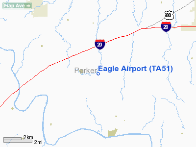
Location & QuickFacts
| FAA Information Effective: | 2008-09-25 |
| Airport Identifier: | TA51 |
| Airport Status: | Operational |
| Longitude/Latitude: | 097-56-14.1380W/32-40-49.4750N
-97.937261/32.680410 (Estimated) |
| Elevation: | 885 ft / 269.75 m (Estimated) |
| Land: | 25 acres |
| From nearest city: | 0 nautical miles E of Brock, TX |
| Location: | Parker County, TX |
| Magnetic Variation: | 07E (1990) |
Owner & Manager
| Ownership: | Privately owned |
| Owner: | Geary L Blair |
| Address: | 231 Young Bend Rd
Brock, TX 76087 |
| Phone number: | 817-596-0850 |
| Manager: | Geary Blair |
| Address: | 231 Young Bend Rd
Brock, TX 76087 |
| Phone number: | 817-596-0850 |
Airport Operations and Facilities
| Airport Use: | Private |
| Wind indicator: | Yes |
| Segmented Circle: | No |
| Control Tower: | No |
| Sectional chart: | San Antonio |
| Region: | ASW - Southwest |
| Boundary ARTCC: | ZFW - Fort Worth |
| Tie-in FSS: | FTW - Fort Worth |
| FSS on Airport: | No |
| FSS Phone: | 817-541-3474 |
| FSS Toll Free: | 1-800-WX-BRIEF |
Runway Information
Runway 17/35
| Dimension: | 2800 x 100 ft / 853.4 x 30.5 m |
| Surface: | TURF, |
| |
Runway 17 |
Runway 35 |
| Traffic Pattern: | Left | Left |
|
Radio Navigation Aids
| ID |
Type |
Name |
Ch |
Freq |
Var |
Dist |
| MWL | NDB | Mineral Wells | | 266.00 | 06E | 8.7 nm |
| GZV | NDB | Brazos River | | 280.00 | 07E | 29.0 nm |
| GHX | NDB | Graham | | 371.00 | 07E | 40.6 nm |
| OIP | NDB | Old Rip | | 410.00 | 07E | 47.4 nm |
| BKD | NDB | Breckenridge | | 245.00 | 07E | 48.4 nm |
| XQH | NDB | Cedar Hill | | 353.00 | 08E | 48.9 nm |
| NFW | TACAN | Nas Jrb Fort Worth | 024X | | 07E | 25.8 nm |
| TTT | VOR/DME | Maverick | 078X | 113.10 | 06E | 46.7 nm |
| MQP | VORTAC | Millsap | 124X | 117.70 | 09E | 4.1 nm |
| JEN | VORTAC | Glen Rose | 097X | 115.00 | 06E | 31.5 nm |
| FUZ | VORTAC | Ranger | 104X | 115.70 | 06E | 40.3 nm |
| FTW | VOT | Fort Worth Meacham | | 108.20 | | 30.4 nm |
Remarks
- PRVDD ALL AIR TRAFFIC OPNS LMTD TO WEST SIDE OF ARPT.
Images and information placed above are from
http://www.airport-data.com/airport/TA51/
We thank them for the data!
| General Info
|
| Country |
United States
|
| State |
TEXAS
|
| FAA ID |
TA51
|
| Latitude |
32-40-49.475N
|
| Longitude |
097-56-14.138W
|
| Elevation |
885 feet
|
| Near City |
BROCK
|
We don't guarantee the information is fresh and accurate. The data may
be wrong or outdated.
For more up-to-date information please refer to other sources.
|
|


