 |
|
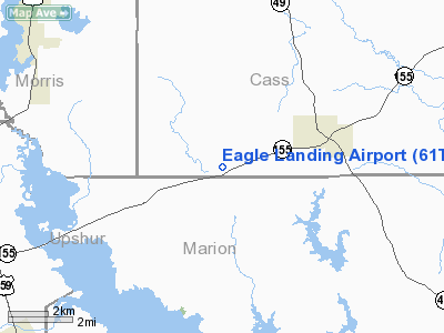
Location & QuickFacts
| FAA Information Effective: | 2008-09-25 |
| Airport Identifier: | 61TA |
| Airport Status: | Operational |
| Longitude/Latitude: | 094-36-27.7300W/32-53-02.4790N
-94.607703/32.884022 (Estimated) |
| Elevation: | 380 ft / 115.82 m (Estimated) |
| Land: | 0 acres |
| From nearest city: | 3 nautical miles SW of Avinger, TX |
| Location: | Cass County, TX |
| Magnetic Variation: | 05E (1985) |
Owner & Manager
| Ownership: | Privately owned |
| Owner: | Eagle Landing Homeowners Assn |
| Address: | P.o. Box 157
Avinger, TX 75630 |
| Phone number: | 903-562-1940 |
| Manager: | Eagle Landing Homeowners Assn |
| Address: | P.o. Box 157
Avinger, TX 75630 |
| Phone number: | 903-562-1773 |
Airport Operations and Facilities
| Airport Use: | Private |
| Wind indicator: | Yes |
| Segmented Circle: | No |
| Control Tower: | No |
| Landing fee charge: | No |
| Sectional chart: | Memphis |
| Region: | ASW - Southwest |
| Boundary ARTCC: | ZFW - Fort Worth |
| Tie-in FSS: | FTW - Fort Worth |
| FSS on Airport: | No |
| FSS Phone: | 817-541-3474 |
| FSS Toll Free: | 1-800-WX-BRIEF |
Runway Information
Runway 07/25
| Dimension: | 4000 x 100 ft / 1219.2 x 30.5 m |
| Surface: | TURF, |
| |
Runway 07 |
Runway 25 |
| Traffic Pattern: | Left | Left |
| Obstruction: | 50 ft trees, 200.0 ft from runway | 50 ft trees, 200.0 ft from runway |
|
Radio Navigation Aids
| ID |
Type |
Name |
Ch |
Freq |
Var |
Dist |
| LST | NDB | Lone Star | | 305.00 | 05E | 7.3 nm |
| ATA | NDB | Atlanta | | 347.00 | 04E | 24.8 nm |
| VIV | NDB | Vivian | | 284.00 | 06E | 30.2 nm |
| ABG | NDB | Ambassador | | 404.00 | 07E | 31.2 nm |
| HNO | NDB | Henderson | | 371.00 | 06E | 43.8 nm |
| RPF | NDB | Carthage | | 332.00 | 04E | 45.2 nm |
| DTN | VOR | Downtown | | 108.60 | 07E | 48.5 nm |
| UIM | VOR/DME | Quitman | 087X | 114.00 | 08E | 38.3 nm |
| GGG | VORTAC | Gregg County | 070X | 112.30 | 07E | 29.0 nm |
| EIC | VORTAC | Belcher | 121X | 117.40 | 07E | 40.9 nm |
| TXK | VORTAC | Texarkana | 110X | 116.30 | 07E | 46.4 nm |
| SHV | VOT | Shreveport Regional | | 108.20 | | 42.2 nm |
Remarks
- CONDL--PRVDD PROVISIONS ARE MADE TO KEEP GROUND TRAFFIC FROM THE ROAD, WHICH CROSSES THE EAST END OF THE RWY.
Images and information placed above are from
http://www.airport-data.com/airport/61TA/
We thank them for the data!
| General Info
|
| Country |
United States
|
| State |
TEXAS
|
| FAA ID |
61TA
|
| Latitude |
32-53-02.479N
|
| Longitude |
094-36-27.730W
|
| Elevation |
380 feet
|
| Near City |
AVINGER
|
We don't guarantee the information is fresh and accurate. The data may
be wrong or outdated.
For more up-to-date information please refer to other sources.
|
|


