 |
|
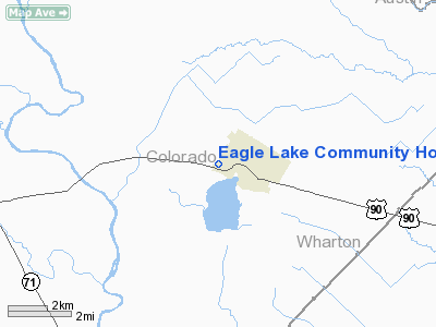
Eagle Lake Community Hospital Heliport |
Location & QuickFacts
| FAA Information Effective: | 2008-09-25 |
| Airport Identifier: | TA39 |
| Airport Status: | Operational |
| Longitude/Latitude: | 096-20-43.8780W/29-35-12.8610N
-96.345522/29.586906 (Estimated) |
| Elevation: | 174 ft / 53.04 m (Estimated) |
| Land: | 0 acres |
| From nearest city: | 2 nautical miles NE of Eagle Lake, TX |
| Location: | Colorado County, TX |
| Magnetic Variation: | 06E (1985) |
Owner & Manager
| Ownership: | Privately owned |
| Owner: | Eagle Lake Community Hospital |
| Address: | 600 S. Austin Rd.
Eagle Lake, TX 77434-3298 |
| Phone number: | 409-234-5571 |
| Manager: | James E. Buckner, Jr |
| Address: | 110 East Stockbridge
Eagle Lake, TX 77434 |
| Phone number: | 409-234-3802 |
Airport Operations and Facilities
| Airport Use: | Private
MEDICAL |
| Wind indicator: | Yes |
| Segmented Circle: | No |
| Control Tower: | No |
| Lighting Schedule: | PHONE REQ
FOR ROTG BCN; PERIMETER LGTS & FLOOD LGTS PHONE 409-234-5571. |
| Beacon Color: | Clear (unlighted land airport) |
| Landing fee charge: | No |
| Sectional chart: | Houston |
| Region: | ASW - Southwest |
| Boundary ARTCC: | ZHU - Houston |
| Tie-in FSS: | CXO - Montgomery County |
| FSS on Airport: | No |
| FSS Toll Free: | 1-800-WX-BRIEF
FOR FP FILING CALL CXO FSS 1-800-833-5602. |
Runway Information
Helipad H1
| Dimension: | 40 x 40 ft / 12.2 x 12.2 m |
| Surface: | CONC, |
| |
Runway H1 |
Runway |
| Traffic Pattern: | Left | Left |
|
Radio Navigation Aids
| ID |
Type |
Name |
Ch |
Freq |
Var |
Dist |
| ARM | NDB | Wharton | | 245.00 | 06E | 22.4 nm |
| SGR | NDB | Hull | | 388.00 | 05E | 36.1 nm |
| LYD | NDB | Lakeside | | 249.00 | 05E | 37.5 nm |
| BNH | NDB | Brenham | | 362.00 | 06E | 38.2 nm |
| EYQ | NDB | Weiser | | 286.00 | 06E | 42.3 nm |
| OKT | NDB | Yoakum | | 350.00 | 06E | 44.7 nm |
| BYY | NDB | Bay City | | 344.00 | 06E | 44.9 nm |
| SYG | NDB | Sandy Point | | 402.00 | 05E | 46.1 nm |
| GYB | NDB | Lee County | | 385.00 | 07E | 48.1 nm |
| ELA | VOR/DME | Eagle Lake | 111X | 116.40 | 08E | 4.8 nm |
| IDU | VORTAC | Industry | 039X | 110.20 | 08E | 24.9 nm |
| TNV | VORTAC | Navasota | 106X | 115.90 | 08E | 44.7 nm |
| PSX | VORTAC | Palacios | 120X | 117.30 | 08E | 49.5 nm |
Remarks
Images and information placed above are from
http://www.airport-data.com/airport/TA39/
We thank them for the data!
| General Info
|
| Country |
United States
|
| State |
TEXAS
|
| FAA ID |
TA39
|
| Latitude |
29-35-12.861N
|
| Longitude |
096-20-43.878W
|
| Elevation |
174 feet
|
| Near City |
EAGLE LAKE
|
We don't guarantee the information is fresh and accurate. The data may
be wrong or outdated.
For more up-to-date information please refer to other sources.
|
|


