 |
|
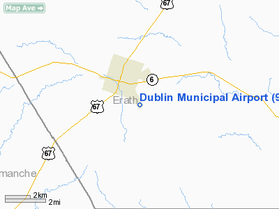
Location & QuickFacts
| FAA Information Effective: | 2008-09-25 |
| Airport Identifier: | 9F0 |
| Airport Status: | Operational |
| Longitude/Latitude: | 098-19-31.1550W/32-04-05.5170N
-98.325321/32.068199 (Estimated) |
| Elevation: | 1495 ft / 455.68 m (Estimated) |
| Land: | 80 acres |
| From nearest city: | 2 nautical miles SE of Dublin, TX |
| Location: | Erath County, TX |
| Magnetic Variation: | 07E (1985) |
Owner & Manager
| Ownership: | Publicly owned |
| Owner: | City Of Dublin |
| Address: | 213 E Black-jack Street
Dublin, TX 76446 |
| Phone number: | 254-445-3331 |
| Manager: | Jerry Guillory
CITY MANAGER. |
| Address: | City Hall
Dublin, TX 76446 |
| Phone number: | 254-445-3331
EMERGENCY PHONE: 254-445-3455. |
Airport Operations and Facilities
| Airport Use: | Open to public |
| Wind indicator: | Yes |
| Segmented Circle: | Yes |
| Control Tower: | No |
| Lighting Schedule: | DUSK-DAWN
ACTVT MIRL RY 15/33 - 123.5. |
| Beacon Color: | Clear-Green (lighted land airport) |
| Landing fee charge: | No |
| Sectional chart: | Dallas-ft Worth |
| Region: | ASW - Southwest |
| Boundary ARTCC: | ZFW - Fort Worth |
| Tie-in FSS: | FTW - Fort Worth |
| FSS on Airport: | No |
| FSS Phone: | 817-541-3474 |
| FSS Toll Free: | 1-800-WX-BRIEF |
| NOTAMs Facility: | FTW (NOTAM-d service avaliable) |
| Federal Agreements: | 1Y |
Airport Communications
Airport Services
Runway Information
Runway 15/33
| Dimension: | 3200 x 60 ft / 975.4 x 18.3 m |
| Surface: | ASPH, Poor Condition
LOOSE ROCKS AND NUMEROUS CRACKS ON RY. |
| Weight Limit: | Single wheel: 22000 lbs. |
| Edge Lights: | Medium |
| |
Runway 15 |
Runway 33 |
| Traffic Pattern: | Left | Left |
| Markings: | Basic, Poor Condition
MARKINGS FADED. | Basic, Poor Condition
MARKINGS FADED. |
| Obstruction: | 13 ft tree, 480.0 ft from runway, 50 ft right of centerline, 21:1 slope to clear | 15 ft tree, 580.0 ft from runway, 50 ft right of centerline, 25:1 slope to clear |
|
Radio Navigation Aids
| ID |
Type |
Name |
Ch |
Freq |
Var |
Dist |
| MNZ | NDB | Hamilton | | 251.00 | 07E | 28.4 nm |
| OIP | NDB | Old Rip | | 410.00 | 07E | 31.7 nm |
| MWL | NDB | Mineral Wells | | 266.00 | 06E | 45.2 nm |
| BKD | NDB | Breckenridge | | 245.00 | 07E | 49.9 nm |
| BWD | VOR/DME | Brownwood | 023X | 108.60 | 08E | 33.9 nm |
| JEN | VORTAC | Glen Rose | 097X | 115.00 | 06E | 23.4 nm |
| MQP | VORTAC | Millsap | 124X | 117.70 | 09E | 42.9 nm |
Images and information placed above are from
http://www.airport-data.com/airport/9F0/
We thank them for the data!
| General Info
|
| Country |
United States
|
| State |
TEXAS
|
| FAA ID |
9F0
|
| Latitude |
32-04-05.517N
|
| Longitude |
098-19-31.155W
|
| Elevation |
1495 feet
|
| Near City |
DUBLIN
|
We don't guarantee the information is fresh and accurate. The data may
be wrong or outdated.
For more up-to-date information please refer to other sources.
|
|


