 |
|
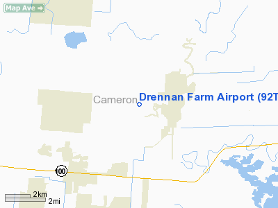
Location & QuickFacts
| FAA Information Effective: | 2008-09-25 |
| Airport Identifier: | 92TA |
| Airport Status: | Operational |
| Longitude/Latitude: | 097-25-40.9350W/26-07-16.2740N
-97.428038/26.121187 (Estimated) |
| Elevation: | 27 ft / 8.23 m (Estimated) |
| Land: | 0 acres |
| From nearest city: | 4 nautical miles NE of Los Fresnos, TX |
| Location: | Cameron County, TX |
| Magnetic Variation: | 07E (1985) |
Owner & Manager
| Ownership: | Privately owned |
| Owner: | John Drennan |
| Address: | Po Box 3817
Brownsville, TX 78520 |
| Phone number: | 956-838-1133 |
| Manager: | John Drennan |
| Address: | Po Box 3817
Brownsville, TX 78520 |
| Phone number: | 956-838-1133 |
Airport Operations and Facilities
| Airport Use: | Private |
| Wind indicator: | No |
| Segmented Circle: | No |
| Control Tower: | No |
| Landing fee charge: | No |
| Sectional chart: | Brownsville |
| Region: | ASW - Southwest |
| Boundary ARTCC: | ZHU - Houston |
| Tie-in FSS: | SJT - San Angelo |
| FSS on Airport: | No |
| FSS Toll Free: | 1-800-WX-BRIEF |
Runway Information
Runway 15/33
| Dimension: | 1500 x 50 ft / 457.2 x 15.2 m |
| Surface: | TURF, |
| |
Runway 15 |
Runway 33 |
| Traffic Pattern: | Left | Left |
| Obstruction: | 20 ft tree, 420.0 ft from runway | 40 ft pline, 950.0 ft from runway |
|
Radio Navigation Aids
| ID |
Type |
Name |
Ch |
Freq |
Var |
Dist |
| REX | VOR | Reynosa | | 112.40 | 08E | 43.8 nm |
| HRL | VOR/DME | Harlingen | 029X | 109.20 | 05E | 13.7 nm |
| MAM | VOR/DME | Matamoros | 090X | 114.30 | 07E | 21.7 nm |
| MFE | VOR/DME | Mc Allen | 119X | 117.20 | 09E | 44.0 nm |
| BRO | VORTAC | Brownsville | 110X | 116.30 | 09E | 12.2 nm |
Remarks
- PROVIDED LNDG THRESHOLDS ARE LOCATED TO PROVIDE CLEAR 20:1 APPROACH SLOPES OVER ANY OBSTRUCTIONS IN THE APPROACH AREAS; 15-FOOT VERTICAL DISTANCE PROVIDED OVER THE ROAD.
Images and information placed above are from
http://www.airport-data.com/airport/92TA/
We thank them for the data!
| General Info
|
| Country |
United States
|
| State |
TEXAS
|
| FAA ID |
92TA
|
| Latitude |
26-07-16.274N
|
| Longitude |
097-25-40.935W
|
| Elevation |
27 feet
|
| Near City |
LOS FRESNOS
|
We don't guarantee the information is fresh and accurate. The data may
be wrong or outdated.
For more up-to-date information please refer to other sources.
|
|


