 |
|
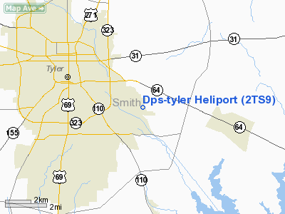
Location & QuickFacts
| FAA Information Effective: | 2008-09-25 |
| Airport Identifier: | 2TS9 |
| Airport Status: | Operational |
| Longitude/Latitude: | 095-14-20.8160W/32-18-50.5430N
-95.239116/32.314040 (Estimated) |
| Elevation: | 570 ft / 173.74 m (Estimated) |
| Land: | 0 acres |
| From nearest city: | 7 nautical miles E of Tyler, TX |
| Location: | Smith County, TX |
| Magnetic Variation: | 06E (1985) |
Owner & Manager
| Ownership: | Publicly owned |
| Owner: | Texas Dept Of Public Safety |
| Address: | Box 4087
Austin, TX 78773 |
| Phone number: | 512-465-2000 |
| Manager: | Carl R. Mullins |
| Address: | 350 Ih 30w
Garland, TX 75043 |
| Phone number: | 214-226-5345 |
Airport Operations and Facilities
| Airport Use: | Private |
| Wind indicator: | Yes |
| Segmented Circle: | No |
| Control Tower: | No |
| Sectional chart: | Dallas-ft Worth |
| Region: | ASW - Southwest |
| Boundary ARTCC: | ZFW - Fort Worth |
| Tie-in FSS: | FTW - Fort Worth |
| FSS Phone: | 817-541-3474 |
| FSS Toll Free: | 1-800-WX-BRIEF |
Runway Information
Helipad H1
| Dimension: | 80 x 80 ft / 24.4 x 24.4 m |
| Surface: | ASPH,
ROOFTOP. |
| |
Runway H1 |
Runway |
| Traffic Pattern: | Left | Left |
|
Radio Navigation Aids
| ID |
Type |
Name |
Ch |
Freq |
Var |
Dist |
| TY | NDB | Tyler | | 320.00 | 06E | 13.2 nm |
| ABG | NDB | Ambassador | | 404.00 | 07E | 17.5 nm |
| HNO | NDB | Henderson | | 371.00 | 06E | 20.7 nm |
| JSO | NDB | Cherokee County | | 263.00 | 05E | 26.7 nm |
| AHX | NDB | Athens | | 269.00 | 06E | 31.5 nm |
| CSZ | NDB | Crossroads | | 215.00 | 08E | 39.5 nm |
| PSN | NDB | Palestine | | 375.00 | 04E | 39.8 nm |
| LIQ | NDB | Lochridge Ranch | | 335.00 | 09E | 40.6 nm |
| LST | NDB | Lone Star | | 305.00 | 05E | 44.6 nm |
| GXD | NDB | Nacogdoches | | 391.00 | 05E | 48.4 nm |
| RPF | NDB | Carthage | | 332.00 | 04E | 48.6 nm |
| TYR | VOR/DME | Tyler | 089X | 114.20 | 06E | 8.7 nm |
| FZT | VOR/DME | Frankston | 051X | 111.40 | 06E | 20.7 nm |
| UIM | VOR/DME | Quitman | 087X | 114.00 | 08E | 34.7 nm |
| GGG | VORTAC | Gregg County | 070X | 112.30 | 07E | 25.4 nm |
Remarks
- VFR; PRIVATE USE; WINDSOCK IS MAINTAINED; GUY WIRES SUPPORTING ANTENNA BE MARKED.
Images and information placed above are from
http://www.airport-data.com/airport/2TS9/
We thank them for the data!
| General Info
|
| Country |
United States
|
| State |
TEXAS
|
| FAA ID |
2TS9
|
| Latitude |
32-18-50.543N
|
| Longitude |
095-14-20.816W
|
| Elevation |
570 feet
|
| Near City |
TYLER
|
We don't guarantee the information is fresh and accurate. The data may
be wrong or outdated.
For more up-to-date information please refer to other sources.
|
|


