 |
|
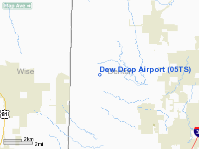
Location & QuickFacts
| FAA Information Effective: | 2008-09-25 |
| Airport Identifier: | 05TS |
| Airport Status: | Operational |
| Longitude/Latitude: | 097-21-31.0700W/33-07-45.4350N
-97.358631/33.129287 (Estimated) |
| Elevation: | 750 ft / 228.60 m (Estimated) |
| Land: | 4 acres |
| From nearest city: | 5 nautical miles NW of Justin, TX |
| Location: | Denton County, TX |
| Magnetic Variation: | 07E (1986) |
Owner & Manager
| Ownership: | Privately owned |
| Owner: | R. J. Nordling |
| Address: | Rt 1 117h
Justin, TX 76247 |
| Phone number: | 817-648-3831 |
| Address: |
|
Airport Operations and Facilities
| Airport Use: | Private |
| Wind indicator: | Yes |
| Segmented Circle: | No |
| Control Tower: | No |
| Sectional chart: | Dallas-ft Worth |
| Region: | ASW - Southwest |
| Boundary ARTCC: | ZFW - Fort Worth |
| Tie-in FSS: | FTW - Fort Worth |
| FSS Phone: | 817-541-3474 |
| FSS Toll Free: | 1-800-WX-BRIEF |
Runway Information
Runway 17/35
| Dimension: | 1700 x 90 ft / 518.2 x 27.4 m |
| Surface: | TURF, |
| |
Runway 17 |
Runway 35 |
| Traffic Pattern: | Left | Left |
| Obstruction: | | 25 ft pline, 600.0 ft from runway |
|
Radio Navigation Aids
| ID |
Type |
Name |
Ch |
Freq |
Var |
Dist |
| GMZ | NDB | Grindstone Mountain | | 356.00 | 07E | 35.4 nm |
| GLE | NDB | Gainesville | | 330.00 | 06E | 36.3 nm |
| RBD | NDB | Redbird | | 287.00 | 06E | 36.7 nm |
| XQH | NDB | Cedar Hill | | 353.00 | 08E | 37.7 nm |
| MWL | NDB | Mineral Wells | | 266.00 | 06E | 40.9 nm |
| PQF | NDB | Mesquite | | 248.00 | 06E | 46.0 nm |
| LNC | NDB | Lancaster | | 239.00 | 06E | 46.2 nm |
| NFW | TACAN | Nas Jrb Fort Worth | 024X | | 07E | 21.9 nm |
| TTT | VOR/DME | Maverick | 078X | 113.10 | 06E | 22.4 nm |
| CVE | VOR/DME | Cowboy | 109X | 116.20 | 06E | 27.0 nm |
| FUZ | VORTAC | Ranger | 104X | 115.70 | 06E | 17.0 nm |
| UKW | VORTAC | Bowie | 071X | 112.40 | 06E | 33.7 nm |
| MQP | VORTAC | Millsap | 124X | 117.70 | 09E | 40.3 nm |
| FTW | VOT | Fort Worth Meacham | | 108.20 | | 18.7 nm |
| DAL | VOT | Dallas Love Field | | 113.30 | | 30.7 nm |
Remarks
- PRVDD VFR, PERSONAL USE ONLY, MUTUALLY COMPATIBLE & SAFE TRAFFIC PATTERNS ARE ESTABLISHED WITH NEARBY AIRPORTS.
Images and information placed above are from
http://www.airport-data.com/airport/05TS/
We thank them for the data!
| General Info
|
| Country |
United States
|
| State |
TEXAS
|
| FAA ID |
05TS
|
| Latitude |
33-07-45.435N
|
| Longitude |
097-21-31.070W
|
| Elevation |
750 feet
|
| Near City |
JUSTIN
|
We don't guarantee the information is fresh and accurate. The data may
be wrong or outdated.
For more up-to-date information please refer to other sources.
|
|


