 |
|
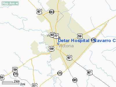
Detar Hospital - Navarro Campus Heliport |
Location & QuickFacts
| FAA Information Effective: | 2008-09-25 |
| Airport Identifier: | XA70 |
| Airport Status: | Operational |
| Longitude/Latitude: | 096-59-48.0000W/28-48-30.0000N
-96.996667/28.808333 (Estimated) |
| Elevation: | 102 ft / 31.09 m (Estimated) |
| Land: | 0 acres |
| From nearest city: | 0 nautical miles N of Victoria, TX |
| Location: | Victoria County, TX |
| Magnetic Variation: | () |
Owner & Manager
| Ownership: | Privately owned |
| Owner: | Detar Hospital |
| Address: | 506 East San Antonio St
Victoria, TX 77901 |
| Phone number: | 361-575-7441 |
| Manager: | William R. Blanchard |
| Address: | 506 East San Antonio St
Victoria, TX 77901 |
| Phone number: | 361-575-7441 |
Airport Operations and Facilities
| Airport Use: | Private
MEDICAL. |
| Wind indicator: | Yes |
| Control Tower: | No |
| Lighting Schedule: | DUSK-DAWN |
| Sectional chart: | Houston |
| Region: | ASW - Southwest |
| Boundary ARTCC: | ZHU - Houston |
| Tie-in FSS: | CXO - Montgomery County |
| FSS Toll Free: | 1-800-WX-BRIEF |
Runway Information
Helipad H1
| Dimension: | 40 x 40 ft / 12.2 x 12.2 m |
| Surface: | CONC, |
| |
Runway H1 |
Runway |
| Traffic Pattern: | Left | Left |
|
Radio Navigation Aids
| ID |
Type |
Name |
Ch |
Freq |
Var |
Dist |
| PKV | NDB | Port Lavaca | | 515.00 | 05E | 19.1 nm |
| OKT | NDB | Yoakum | | 350.00 | 06E | 31.2 nm |
| MNO | NDB | Mellon Ranch | | 375.00 | 06E | 33.6 nm |
| RKP | NDB | Rockport | | 391.00 | 06E | 43.2 nm |
| BEA | NDB | Beeville | | 284.00 | 07E | 49.8 nm |
| VCT | VOR/DME | Victoria | 027X | 109.00 | 06E | 5.6 nm |
| PSX | VORTAC | Palacios | 120X | 117.30 | 08E | 36.5 nm |
Images and information placed above are from
http://www.airport-data.com/airport/XA70/
We thank them for the data!
|
|


