 |
|
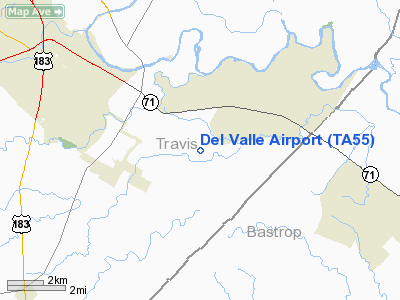
Location & QuickFacts
| FAA Information Effective: | 2008-09-25 |
| Airport Identifier: | TA55 |
| Airport Status: | Operational |
| Longitude/Latitude: | 097-35-34.0000W/30-10-03.7670N
-97.592778/30.167713 (Estimated) |
| Elevation: | 460 ft / 140.21 m (Estimated) |
| Land: | 0 acres |
| From nearest city: | 5 nautical miles SE of Del Valle, TX |
| Location: | Travis County, TX |
| Magnetic Variation: | 07E (1985) |
Owner & Manager
| Ownership: | Privately owned |
| Owner: | Bobby R. Thomas |
| Address: | P.o. Box 57
De Valle, TX 78617 |
| Phone number: | 512-247-4659 |
| Manager: | Bobby R. Thomas |
| Address: | P.o. Box 57
De Valle, TX 78617 |
| Phone number: | 512-243-1157 |
Airport Operations and Facilities
| Airport Use: | Private |
| Wind indicator: | Yes |
| Segmented Circle: | Yes |
| Control Tower: | No |
| Landing fee charge: | No |
| Sectional chart: | Houston |
| Region: | ASW - Southwest |
| Traffic Pattern Alt: | 700 ft |
| Boundary ARTCC: | ZHU - Houston |
| Tie-in FSS: | SJT - San Angelo |
| FSS on Airport: | No |
| FSS Toll Free: | 1-800-WX-BRIEF |
Runway Information
Runway 02/20
| Dimension: | 2200 x 100 ft / 670.6 x 30.5 m |
| Surface: | TURF, |
| |
Runway 02 |
Runway 20 |
| Traffic Pattern: | Right | Left |
|
Radio Navigation Aids
| ID |
Type |
Name |
Ch |
Freq |
Var |
Dist |
| GUO | NDB | Georgetown | | 332.00 | 06E | 31.4 nm |
| GYB | NDB | Lee County | | 385.00 | 07E | 31.9 nm |
| MFS | NDB | Horseshoe Bay Resort | | 403.00 | 07E | 45.1 nm |
| BMQ | NDB | Burnet | | 341.00 | 07E | 47.9 nm |
| CWK | VORTAC | Centex | 075X | 112.80 | 06E | 13.1 nm |
Remarks
- (E111-2) E111 CONT'D: BEFORE CROSSING THE BERGSTROM AFB TRAFFIC AREA.
- E111: PRVDD ALL OPNS ARE UNDER VFR CONDS NOW & IN THE FUTURE; TFC PATTERN WILL BE TO THE EAST OF ARPT; DEPARTING TFC WILL RMN UNDER 700' AGL... E111 CONT'D: UNTIL 2 NM EAST OR SOUTH OF ARPT BEFORE PROCDNG ON NORTH; SOUTH OR EAST RTES; THOSE PROCDNG WEST WILL CLIMB TO 3500' MSL...
Images and information placed above are from
http://www.airport-data.com/airport/TA55/
We thank them for the data!
| General Info
|
| Country |
United States
|
| State |
TEXAS
|
| FAA ID |
TA55
|
| Latitude |
30-10-03.767N
|
| Longitude |
097-35-34.000W
|
| Elevation |
460 feet
|
| Near City |
DEL VALLE
|
We don't guarantee the information is fresh and accurate. The data may
be wrong or outdated.
For more up-to-date information please refer to other sources.
|
|


