 |
|
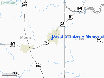
David Granberry Memorial Hospital Heliport |
Location & QuickFacts
| FAA Information Effective: | 2008-09-25 |
| Airport Identifier: | 99TS |
| Airport Status: | Operational |
| Longitude/Latitude: | 094-40-52.7390W/33-11-53.4380N
-94.681316/33.198177 (Estimated) |
| Elevation: | 421 ft / 128.32 m (Estimated) |
| Land: | 0 acres |
| From nearest city: | 0 nautical miles N of Naples, TX |
| Location: | Morris County, TX |
| Magnetic Variation: | 06E (1985) |
Owner & Manager
| Ownership: | Privately owned |
| Owner: | David Granberry Memorial Hos |
| Address: | Po Box 38
Naples, TX 75568 |
| Phone number: | 214-897-5643 |
| Address: |
|
Airport Operations and Facilities
| Airport Use: | Private
MEDICAL. |
| Segmented Circle: | No |
| Control Tower: | No |
| Sectional chart: | Memphis |
| Region: | ASW - Southwest |
| Boundary ARTCC: | ZFW - Fort Worth |
| Tie-in FSS: | FTW - Fort Worth |
| FSS Phone: | 817-541-3474 |
| FSS Toll Free: | 1-800-WX-BRIEF |
Runway Information
Helipad H1
| Dimension: | 20 x 20 ft / 6.1 x 6.1 m |
| Surface: | CONC, |
| |
Runway H1 |
Runway |
| Traffic Pattern: | Left | Left |
|
Radio Navigation Aids
| ID |
Type |
Name |
Ch |
Freq |
Var |
Dist |
| LST | NDB | Lone Star | | 305.00 | 05E | 16.5 nm |
| ATA | NDB | Atlanta | | 347.00 | 04E | 25.3 nm |
| VIV | NDB | Vivian | | 284.00 | 06E | 39.5 nm |
| ABG | NDB | Ambassador | | 404.00 | 07E | 42.8 nm |
| IBO | NDB | Idabel | | 271.00 | 03E | 43.3 nm |
| UIM | VOR/DME | Quitman | 087X | 114.00 | 08E | 39.5 nm |
| SLR | VOR/DME | Sulphur Springs | 027X | 109.00 | 08E | 43.3 nm |
| PRX | VOR/DME | Paris | 083X | 113.60 | 07E | 43.7 nm |
| TXK | VORTAC | Texarkana | 110X | 116.30 | 07E | 35.9 nm |
| GGG | VORTAC | Gregg County | 070X | 112.30 | 07E | 47.1 nm |
Remarks
- VFR; PRIVATE USE ONLY; WINDSOCK IS VSB FM AIR & GND; DAY & NGT; WRNG SIGN IS ERECTED; ACCESS IS RESTRICTED; WIRES ARE OBSTRUCTION MKD; OLD HELIPORT MKGS REMOVED.
Images and information placed above are from
http://www.airport-data.com/airport/99TS/
We thank them for the data!
| General Info
|
| Country |
United States
|
| State |
TEXAS
|
| FAA ID |
99TS
|
| Latitude |
33-11-53.438N
|
| Longitude |
094-40-52.739W
|
| Elevation |
421 feet
|
| Near City |
NAPLES
|
We don't guarantee the information is fresh and accurate. The data may
be wrong or outdated.
For more up-to-date information please refer to other sources.
|
|


