 |
|
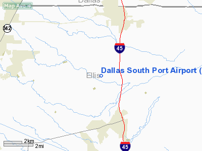
Dallas South Port Airport |
Location & QuickFacts
| FAA Information Effective: | 2008-09-25 |
| Airport Identifier: | T13 |
| Airport Status: | Operational |
| Longitude/Latitude: | 096-41-07.5000W/32-28-38.5800N
-96.685417/32.477383 (Estimated) |
| Elevation: | 474 ft / 144.48 m (Estimated) |
| Land: | 0 acres |
| From nearest city: | 3 nautical miles N of Palmer, TX |
| Location: | Ellis County, TX |
| Magnetic Variation: | () |
Owner & Manager
| Ownership: | Privately owned |
| Owner: | N. L. Craddock |
| Address: | 499 E. Bear Creek Rd
Glenn Heights, TX 75154 |
| Phone number: | 972-223-5666 |
| Manager: | N. L. Craddock |
| Address: | 499 E. Bear Creek Rd
Glenn Heights, TX 75154 |
| Phone number: | 972-842-8798 |
Airport Operations and Facilities
| Airport Use: | Open to public |
| Wind indicator: | Yes |
| Control Tower: | No |
| Sectional chart: | Dallas-ft Worth |
| Region: | ASW - Southwest |
| Boundary ARTCC: | ZFW - Fort Worth |
| Tie-in FSS: | FTW - Fort Worth |
| FSS Phone: | 817-541-3474 |
| FSS Toll Free: | 1-800-WX-BRIEF |
| NOTAMs Facility: | FTW (NOTAM-d service avaliable) |
Airport Communications
Runway Information
Runway 17/35
| Dimension: | 3800 x 100 ft / 1158.2 x 30.5 m |
| Surface: | TURF, |
| |
Runway 17 |
Runway 35 |
| Traffic Pattern: | Left | Left |
|
Radio Navigation Aids
| ID |
Type |
Name |
Ch |
Freq |
Var |
Dist |
| LNC | NDB | Lancaster | | 239.00 | 06E | 6.3 nm |
| JUG | NDB | Jecca | | 388.00 | 06E | 13.8 nm |
| RBD | NDB | Redbird | | 287.00 | 06E | 15.2 nm |
| XQH | NDB | Cedar Hill | | 353.00 | 08E | 16.3 nm |
| PQF | NDB | Mesquite | | 248.00 | 06E | 21.5 nm |
| AVZ | NDB | Travis | | 260.00 | 06E | 27.9 nm |
| CGQ | NDB | Powell | | 344.00 | 06E | 28.1 nm |
| CRS | NDB | Corsicana | | 396.00 | 06E | 30.8 nm |
| MII | NDB | Caddo Mills | | 316.00 | 06E | 40.4 nm |
| SYW | NDB | Cash | | 428.00 | 05E | 43.5 nm |
| PYF | NDB | Pyramid | | 418.00 | 06E | 44.5 nm |
| CSZ | NDB | Crossroads | | 215.00 | 08E | 44.6 nm |
| LIQ | NDB | Lochridge Ranch | | 335.00 | 09E | 46.6 nm |
| AHX | NDB | Athens | | 269.00 | 06E | 47.5 nm |
| NFW | TACAN | Nas Jrb Fort Worth | 024X | | 07E | 42.1 nm |
| MJF | TACAN | Arvilla | 033X | | 05E | 47.4 nm |
| CVE | VOR/DME | Cowboy | 109X | 116.20 | 06E | 27.2 nm |
| TTT | VOR/DME | Maverick | 078X | 113.10 | 06E | 29.6 nm |
| CQY | VORTAC | Cedar Creek | 095X | 114.80 | 06E | 29.5 nm |
| FUZ | VORTAC | Ranger | 104X | 115.70 | 06E | 35.2 nm |
| DAL | VOT | Dallas Love Field | | 113.30 | | 23.8 nm |
| FTW | VOT | Fort Worth Meacham | | 108.20 | | 39.7 nm |
Remarks
- PRVDD LOA W/HARPEE ARPT RE TRAFFIC PATTERNS.
Images and information placed above are from
http://www.airport-data.com/airport/T13/
We thank them for the data!
| General Info
|
| Country |
United States
|
| State |
TEXAS
|
| FAA ID |
T13
|
| Latitude |
29-49-00.792N
|
| Longitude |
099-47-16.221W
|
| Elevation |
1730 feet
|
| Near City |
LEAKEY
|
We don't guarantee the information is fresh and accurate. The data may
be wrong or outdated.
For more up-to-date information please refer to other sources.
|
|


