 |
|
Location & QuickFacts
| FAA Information Effective: | 2008-09-25 |
| Airport Identifier: | TE42 |
| Airport Status: | Operational |
| Longitude/Latitude: | 097-23-04.9700W/27-44-55.1070N
-97.384714/27.748641 (Estimated) |
| Elevation: | 31 ft / 9.45 m (Estimated) |
| Land: | 0 acres |
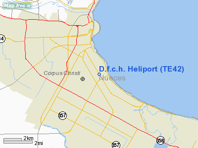
| From nearest city: | 0 nautical miles N of Corpus Christi, TX |
| Location: | Nueces County, TX |
| Magnetic Variation: | 07E (1985) |
Owner & Manager
| Ownership: | Privately owned |
| Owner: | Driscoll Foundation Chil Hos |
| Address: | 3533 S. Alameda
Corpus Christi, TX 78411 |
| Phone number: | 512-850-5000 |
| Manager: | Garland Allen
VICE PRESIDENT-GENERAL SERVICES. |
| Address: | Po Box 6530
Corpus Christi, TX 78411 |
| Phone number: | 512-850-5030 |
Airport Operations and Facilities
| Airport Use: | Private
MEDICAL |
| Segmented Circle: | No |
| Control Tower: | No |
| Lighting Schedule: | SS-SR |
| Sectional chart: | Brownsville |
| Region: | ASW - Southwest |
| Boundary ARTCC: | ZHU - Houston |
| Tie-in FSS: | SJT - San Angelo |
| FSS Toll Free: | 1-800-WX-BRIEF |
Runway Information
Helipad H1
| Dimension: | 40 x 40 ft / 12.2 x 12.2 m |
| Surface: | CONC, |
| |
Runway H1 |
Runway |
| Traffic Pattern: | Left | Left |
|
Radio Navigation Aids
| ID |
Type |
Name |
Ch |
Freq |
Var |
Dist |
| RKP | NDB | Rockport | | 391.00 | 06E | 27.3 nm |
| MNO | NDB | Mellon Ranch | | 375.00 | 06E | 33.3 nm |
| TKB | NDB | Kleberg County | | 347.00 | 06E | 38.3 nm |
| BEA | NDB | Beeville | | 284.00 | 07E | 43.2 nm |
| NQI | TACAN | Kingsville | 125X | | 09E | 27.0 nm |
| NOG | TACAN | Orange Grove | 063X | | 09E | 36.1 nm |
| ALI | VOR | Alice | | 114.50 | 06E | 33.9 nm |
| NGP | VORTAC | Truax | 087X | 114.00 | 06E | 6.1 nm |
| CRP | VORTAC | Corpus Christi | 102X | 115.50 | 09E | 9.9 nm |
Images and information placed above are from
http://www.airport-data.com/airport/TE42/
We thank them for the data!
| General Info
|
| Country |
United States
|
| State |
TEXAS
|
| FAA ID |
TE42
|
| Latitude |
27-44-55.107N
|
| Longitude |
097-23-04.970W
|
| Elevation |
31 feet
|
| Near City |
CORPUS CHRISTI
|
We don't guarantee the information is fresh and accurate. The data may
be wrong or outdated.
For more up-to-date information please refer to other sources.
|
|


