 |
|
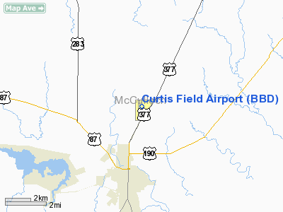
Location & QuickFacts
| FAA Information Effective: | 2008-09-25 |
| Airport Identifier: | BBD |
| Airport Status: | Operational |
| Longitude/Latitude: | 099-19-26.1000W/31-10-45.4000N
-99.323917/31.179278 (Estimated) |
| Elevation: | 1827 ft / 556.87 m (Surveyed) |
| Land: | 450 acres |
| From nearest city: | 3 nautical miles NE of Brady, TX |
| Location: | Mc Culloch County, TX |
| Magnetic Variation: | 07E (1995) |
Owner & Manager
| Ownership: | Publicly owned |
| Owner: | City Of Brady |
| Address: | Po Box 351
Brady, TX 76825 |
| Phone number: | 325-597-2152 |
| Manager: | Joe Mosier |
| Address: | Box 223
Brady, TX 76825 |
| Phone number: | 325-597-1461 |
Airport Operations and Facilities
| Airport Use: | Open to public |
| Wind indicator: | Yes |
| Segmented Circle: | Yes |
| Control Tower: | No |
| Lighting Schedule: | DUSK-DAWN
ACTVT MIRL RY 17/35 - CTAF. |
| Beacon Color: | Clear-Green (lighted land airport) |
| Landing fee charge: | No |
| Sectional chart: | San Antonio |
| Region: | ASW - Southwest |
| Boundary ARTCC: | ZHU - Houston |
| Tie-in FSS: | SJT - San Angelo |
| FSS on Airport: | No |
| FSS Toll Free: | 1-800-WX-BRIEF |
| NOTAMs Facility: | SJT (NOTAM-d service avaliable) |
| Federal Agreements: | NR |
Airport Communications
| CTAF: | 122.800 |
| Unicom: | 122.800 |
Airport Services
| Fuel available: | 100LLA
FOR FUEL OR ATTENDANT AFT HRS CALL 325-597-2445. |
| Airframe Repair: | MINOR |
| Power Plant Repair: | MINOR |
| Bottled Oxygen: | NONE |
| Bulk Oxygen: | NONE |
Runway Information
Runway 08/26
| Dimension: | 3520 x 110 ft / 1072.9 x 33.5 m |
| Surface: | TURF, Fair Condition
WEST END VERY ROUGH. |
| |
Runway 08 |
Runway 26 |
| Longitude: | 099-19-43.0393W | 099-19-02.5904W |
| Latitude: | 31-10-47.9695N | 31-10-45.9007N |
| Elevation: | 1812.00 ft | 1823.00 ft |
| Alignment: | 93 | 127 |
| Traffic Pattern: | Left | Left |
| Obstruction: | 5 ft fence, 213.0 ft from runway, 42:1 slope to clear | 5 ft fence, 230.0 ft from runway, 46:1 slope to clear |
|
Runway 17/35
| Dimension: | 4605 x 75 ft / 1403.6 x 22.9 m |
| Surface: | ASPH, Good Condition
WEST END VERY ROUGH. |
| Weight Limit: | Single wheel: 21000 lbs. |
| Edge Lights: | Medium |
| |
Runway 17 |
Runway 35 |
| Longitude: | 099-19-28.6068W | 099-19-28.7417W |
| Latitude: | 31-11-07.0766N | 31-10-21.5090N |
| Elevation: | 1826.00 ft | 1792.00 ft |
| Alignment: | 127 | 0 |
| Traffic Pattern: | Left | Left |
| Markings: | Non-precision instrument, Good Condition | Non-precision instrument, Good Condition |
| Crossing Height: | 40.00 ft | 40.00 ft |
| Displaced threshold: | 586.00 ft | 0.00 ft |
| VASI: | 2-light PAPI on left side | 2-light PAPI on left side |
| Visual Glide Angle: | 3.00° | 3.00° |
|
Radio Navigation Aids
| ID |
Type |
Name |
Ch |
Freq |
Var |
Dist |
| BBD | NDB | Brady | | 380.00 | 07E | 0.1 nm |
| COM | NDB | Coleman | | 385.00 | 07E | 40.0 nm |
| UBC | NDB | Ballinger | | 239.00 | 08E | 45.0 nm |
| BWD | VOR/DME | Brownwood | 023X | 108.60 | 08E | 46.8 nm |
| LLO | VORTAC | Llano | 019X | 108.20 | 08E | 36.0 nm |
| JCT | VORTAC | Junction | 107X | 116.00 | 08E | 43.2 nm |
Remarks
- OVER NIGHT TIE DOWN FEE.
- DEER ON & INVOF ARPT.
- PRE-DATES THE ACT.
Images and information placed above are from
http://www.airport-data.com/airport/BBD/
We thank them for the data!
| General Info
|
| Country |
United States
|
| State |
TEXAS
|
| FAA ID |
BBD
|
| Latitude |
31-10-41.400N
|
| Longitude |
099-19-28.700W
|
| Elevation |
1827 feet
|
| Near City |
BRADY
|
We don't guarantee the information is fresh and accurate. The data may
be wrong or outdated.
For more up-to-date information please refer to other sources.
|
|


