 |
|
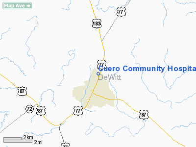
Cuero Community Hospital Heliport |
Location & QuickFacts
| FAA Information Effective: | 2008-09-25 |
| Airport Identifier: | 2TE9 |
| Airport Status: | Operational |
| Longitude/Latitude: | 097-16-59.9630W/29-06-47.9120N
-97.283323/29.113309 (Estimated) |
| Elevation: | 210 ft / 64.01 m (Estimated) |
| Land: | 0 acres |
| From nearest city: | 2 nautical miles N of Cuero, TX |
| Location: | De Witt County, TX |
| Magnetic Variation: | 07E (1985) |
Owner & Manager
| Ownership: | Privately owned |
| Owner: | Cuero Community Hospital |
| Address: | Box 807 Yoakum Highway
Cuero, TX 77954 |
| Phone number: | 512-275-6191 |
| Manager: | Larry Krupala |
| Address: | Box 807 Yoakum Highway
Cuero, TX 77954 |
| Phone number: | 512-275-6191 |
Airport Operations and Facilities
| Airport Use: | Private
MEDICAL. |
| Wind indicator: | Yes |
| Segmented Circle: | No |
| Control Tower: | No |
| Sectional chart: | San Antonio |
| Region: | ASW - Southwest |
| Boundary ARTCC: | ZHU - Houston |
| Tie-in FSS: | CXO - Montgomery County |
| FSS on Airport: | No |
| FSS Toll Free: | 1-800-WX-BRIEF
FOR FP FILING CALL CXO FSS 1-800-833-5602. |
Runway Information
Helipad H1
| Dimension: | 40 x 40 ft / 12.2 x 12.2 m |
| Surface: | CONC, |
| |
Runway H1 |
Runway |
| Traffic Pattern: | Left | Left |
|
Radio Navigation Aids
| ID |
Type |
Name |
Ch |
Freq |
Var |
Dist |
| OKT | NDB | Yoakum | | 350.00 | 06E | 14.2 nm |
| PKV | NDB | Port Lavaca | | 515.00 | 05E | 42.1 nm |
| VCT | VOR/DME | Victoria | 027X | 109.00 | 06E | 20.5 nm |
Images and information placed above are from
http://www.airport-data.com/airport/2TE9/
We thank them for the data!
| General Info
|
| Country |
United States
|
| State |
TEXAS
|
| FAA ID |
2TE9
|
| Latitude |
29-06-47.912N
|
| Longitude |
097-16-59.963W
|
| Elevation |
210 feet
|
| Near City |
CUERO
|
We don't guarantee the information is fresh and accurate. The data may
be wrong or outdated.
For more up-to-date information please refer to other sources.
|
|


