 |
|
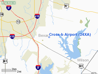
Location & QuickFacts
| FAA Information Effective: | 2008-09-25 |
| Airport Identifier: | 24XA |
| Airport Status: | Operational |
| Longitude/Latitude: | 098-22-13.0600W/29-19-15.4900N
-98.370294/29.320969 (Estimated) |
| Elevation: | 530 ft / 161.54 m (Estimated) |
| Land: | 0 acres |
| From nearest city: | 10 nautical miles SE of San Antonio, TX |
| Location: | Bexar County, TX |
| Magnetic Variation: | () |
Owner & Manager
| Ownership: | Privately owned |
| Owner: | Fred Seabers |
| Address: | 9375 Hildebrandt Rd
San Antonio, TX 78222 |
| Phone number: | 210-633-2126 |
| Manager: | Fred Seabers |
| Address: | 9375 Hildebrandt Rd
San Antonio, TX 78222 |
| Phone number: | 210-633-2126 |
Airport Operations and Facilities
| Airport Use: | Private |
| Control Tower: | No |
| Sectional chart: | Houston |
| Region: | ASW - Southwest |
| Boundary ARTCC: | ZHU - Houston |
| Tie-in FSS: | SJT - San Angelo |
| FSS Toll Free: | 1-800-WX-BRIEF |
Runway Information
Runway 12/30
| Dimension: | 2000 x 100 ft / 609.6 x 30.5 m |
| Surface: | TURF, |
| |
Runway 12 |
Runway 30 |
| Traffic Pattern: | Left | Left |
|
Radio Navigation Aids
| ID |
Type |
Name |
Ch |
Freq |
Var |
Dist |
| PEZ | NDB | Pleasanton | | 275.00 | 07E | 23.3 nm |
| CVB | NDB | Castroville | | 338.00 | 08E | 25.1 nm |
| HHH | NDB | Devine | | 359.00 | 07E | 31.8 nm |
| HMA | NDB | Hondo | | 329.00 | 08E | 42.1 nm |
| ER | NDB | Shein | | 263.00 | 08E | 48.9 nm |
| KSY | TACAN | Kelly | 057X | | 07E | 11.8 nm |
| DHK | TACAN | Randolph | 036X | | 09E | 14.0 nm |
| SSF | VOR | Stinson | | 108.40 | 09E | 5.4 nm |
| HDO | VOR/DME | Hondo | 31X | 109.40 | 08E | 42.4 nm |
| RND | VORTAC | Randolph | 70X | 112.30 | 09E | 12.7 nm |
| SAT | VORTAC | San Antonio | 115X | 116.80 | 08E | 20.0 nm |
| SAT | VOT | San Antonio Intl | | 110.40 | | 13.8 nm |
Remarks
- 1000 FT RADIO TWR 1 NM NE; 100 FT PLINE 3/4 NM NW;AND 700 FT SMOKE STACK 3 NM SE.
Images and information placed above are from
http://www.airport-data.com/airport/24XA/
We thank them for the data!
|
|


