 |
|
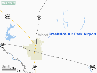
Creekside Air Park Airport |
Location & QuickFacts
| FAA Information Effective: | 2008-09-25 |
| Airport Identifier: | XA46 |
| Airport Status: | Operational |
| Longitude/Latitude: | 095-27-15.7000W/32-41-37.0900N
-95.454361/32.693636 (Estimated) |
| Elevation: | 450 ft / 137.16 m (Estimated) |
| Land: | 60 acres |
| From nearest city: | 2 nautical miles N of Mineola, TX |
| Location: | Wood County, TX |
| Magnetic Variation: | () |
Owner & Manager
| Ownership: | Privately owned |
| Owner: | Jeff B. Taylor |
| Address: | P. O. Box 688
Mineola, TX 75773 |
| Phone number: | 903-569-3669 |
| Manager: | Jeff B. Taylor |
| Address: | P. O. Box 688
Mineola, TX 75773 |
| Phone number: | 903-569-3669 |
Airport Operations and Facilities
| Airport Use: | Private |
| Wind indicator: | Yes |
| Control Tower: | No |
| Sectional chart: | Dallas-ft Worth |
| Region: | ASW - Southwest |
| Boundary ARTCC: | ZFW - Fort Worth |
| Tie-in FSS: | FTW - Fort Worth |
| FSS Phone: | 817-541-3474 |
| FSS Toll Free: | 1-800-WX-BRIEF |
Runway Information
Runway 17/35
| Dimension: | 2300 x 60 ft / 701.0 x 18.3 m |
| Surface: | TURF, |
| |
Runway 17 |
Runway 35 |
| Traffic Pattern: | Left | Left |
| Obstruction: | | 40 ft trees, 100.0 ft from runway |
|
Radio Navigation Aids
| ID |
Type |
Name |
Ch |
Freq |
Var |
Dist |
| TY | NDB | Tyler | | 320.00 | 06E | 16.7 nm |
| ABG | NDB | Ambassador | | 404.00 | 07E | 18.5 nm |
| SYW | NDB | Cash | | 428.00 | 05E | 35.5 nm |
| AHX | NDB | Athens | | 269.00 | 06E | 37.4 nm |
| LST | NDB | Lone Star | | 305.00 | 05E | 38.6 nm |
| AVZ | NDB | Travis | | 260.00 | 06E | 40.4 nm |
| HNO | NDB | Henderson | | 371.00 | 06E | 42.8 nm |
| MII | NDB | Caddo Mills | | 316.00 | 06E | 45.2 nm |
| CSZ | NDB | Crossroads | | 215.00 | 08E | 45.7 nm |
| LIQ | NDB | Lochridge Ranch | | 335.00 | 09E | 48.2 nm |
| MJF | TACAN | Arvilla | 033X | | 05E | 38.0 nm |
| UIM | VOR/DME | Quitman | 087X | 114.00 | 08E | 12.1 nm |
| TYR | VOR/DME | Tyler | 089X | 114.20 | 06E | 20.5 nm |
| SLR | VOR/DME | Sulphur Springs | 027X | 109.00 | 08E | 30.7 nm |
| FZT | VOR/DME | Frankston | 051X | 111.40 | 06E | 37.4 nm |
| GGG | VORTAC | Gregg County | 070X | 112.30 | 07E | 39.2 nm |
| CQY | VORTAC | Cedar Creek | 095X | 114.80 | 06E | 49.3 nm |
Images and information placed above are from
http://www.airport-data.com/airport/XA46/
We thank them for the data!
|
|


