 |
|
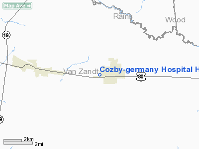
Cozby-germany Hospital Heliport |
Location & QuickFacts
| FAA Information Effective: | 2008-09-25 |
| Airport Identifier: | XA01 |
| Airport Status: | Operational |
| Longitude/Latitude: | 095-43-34.6000W/32-40-34.3000N
-95.726278/32.676194 (Estimated) |
| Elevation: | 152 ft / 46.33 m (Estimated) |
| Land: | 0 acres |
| From nearest city: | 1 nautical miles N of Grand Saline, TX |
| Location: | Van Zandt County, TX |
| Magnetic Variation: | () |
Owner & Manager
| Ownership: | Privately owned |
| Owner: | Cozby-germany Hospital |
| Address: | 707 N Waldrip
Grand Saline, TX 75140 |
| Phone number: | 903-962-4242 |
| Manager: | Coby-germany Hospital |
| Address: | 707 N Waldrip
Grand Saline, TX 75140 |
| Phone number: | 903-962-4242 |
Airport Operations and Facilities
| Airport Use: | Private
MEDICAL USE. |
| Wind indicator: | Yes |
| Segmented Circle: | No |
| Control Tower: | No |
| Sectional chart: | Dallas-ft Worth |
| Region: | ASW - Southwest |
| Boundary ARTCC: | ZFW - Fort Worth |
| Tie-in FSS: | FTW - Fort Worth |
| FSS Phone: | 817-541-3474 |
| FSS Toll Free: | 1-800-WX-BRIEF |
Runway Information
Helipad H1
| Dimension: | 100 x 100 ft / 30.5 x 30.5 m |
| Surface: | CONC, |
| |
Runway H1 |
Runway |
| Traffic Pattern: | Left | Left |
|
Radio Navigation Aids
| ID |
Type |
Name |
Ch |
Freq |
Var |
Dist |
| TY | NDB | Tyler | | 320.00 | 06E | 20.4 nm |
| SYW | NDB | Cash | | 428.00 | 05E | 25.2 nm |
| AVZ | NDB | Travis | | 260.00 | 06E | 26.9 nm |
| AHX | NDB | Athens | | 269.00 | 06E | 31.5 nm |
| ABG | NDB | Ambassador | | 404.00 | 07E | 31.5 nm |
| MII | NDB | Caddo Mills | | 316.00 | 06E | 34.3 nm |
| CSZ | NDB | Crossroads | | 215.00 | 08E | 38.7 nm |
| JUG | NDB | Jecca | | 388.00 | 06E | 40.8 nm |
| PQF | NDB | Mesquite | | 248.00 | 06E | 41.4 nm |
| LIQ | NDB | Lochridge Ranch | | 335.00 | 09E | 41.6 nm |
| MJF | TACAN | Arvilla | 033X | | 05E | 28.9 nm |
| UIM | VOR/DME | Quitman | 087X | 114.00 | 08E | 21.9 nm |
| TYR | VOR/DME | Tyler | 089X | 114.20 | 06E | 25.3 nm |
| SLR | VOR/DME | Sulphur Springs | 027X | 109.00 | 08E | 32.7 nm |
| FZT | VOR/DME | Frankston | 051X | 111.40 | 06E | 37.5 nm |
| CQY | VORTAC | Cedar Creek | 095X | 114.80 | 06E | 38.6 nm |
Remarks
- PRVDD EXISTING OR CONTEMPLATED TFC PATTERNS OF NEIGHBORING ARPTS, EXISTING AIRSPACE STRUCTURE AND PROJECTED FILE WITH FAA.
Images and information placed above are from
http://www.airport-data.com/airport/XA01/
We thank them for the data!
|
|


