 |
|
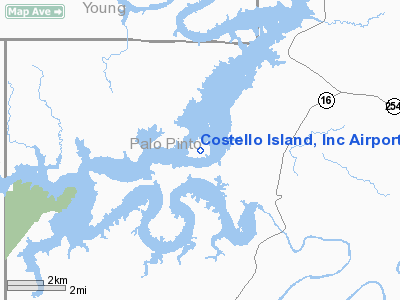
Costello Island, Inc Airport |
Location & QuickFacts
| FAA Information Effective: | 2008-09-25 |
| Airport Identifier: | 4TA3 |
| Airport Status: | Operational |
| Longitude/Latitude: | 098-27-36.1930W/32-53-55.4370N
-98.460054/32.898733 (Estimated) |
| Elevation: | 1020 ft / 310.90 m (Estimated) |
| Land: | 0 acres |
| From nearest city: | 16 nautical miles SE of Graham, TX |
| Location: | Palo Pinto County, TX |
| Magnetic Variation: | 07E (1985) |
Owner & Manager
| Ownership: | Privately owned |
| Owner: | Costello Island, Inc. |
| Address: | 3123 Lawrence
Wichita Falls, TX 76308 |
| Manager: | Joe A. Best, Iii |
| Address: | 4570 Westgrove Suite 270
Dallas, TX 75248 |
| Phone number: | 214-248-2455 |
Airport Operations and Facilities
| Airport Use: | Private |
| Wind indicator: | Yes |
| Segmented Circle: | No |
| Control Tower: | No |
| Landing fee charge: | No |
| Sectional chart: | Dallas-ft Worth |
| Region: | ASW - Southwest |
| Boundary ARTCC: | ZFW - Fort Worth |
| Tie-in FSS: | FTW - Fort Worth |
| FSS on Airport: | No |
| FSS Phone: | 817-541-3474 |
| FSS Toll Free: | 1-800-WX-BRIEF |
Runway Information
Runway 17/35
| Dimension: | 2600 x 75 ft / 792.5 x 22.9 m |
| Surface: | TURF, |
| |
Runway 17 |
Runway 35 |
| Traffic Pattern: | Left | Left |
| Obstruction: | | 690 ft mtn, 6000.0 ft from runway |
|
Radio Navigation Aids
| ID |
Type |
Name |
Ch |
Freq |
Var |
Dist |
| GZV | NDB | Brazos River | | 280.00 | 07E | 4.0 nm |
| GHX | NDB | Graham | | 371.00 | 07E | 16.2 nm |
| MWL | NDB | Mineral Wells | | 266.00 | 06E | 21.5 nm |
| BKD | NDB | Breckenridge | | 245.00 | 07E | 23.6 nm |
| ONY | NDB | Olney | | 272.00 | 07E | 32.6 nm |
| OIP | NDB | Old Rip | | 410.00 | 07E | 34.9 nm |
| MQP | VORTAC | Millsap | 124X | 117.70 | 09E | 25.6 nm |
| UKW | VORTAC | Bowie | 071X | 112.40 | 06E | 50.0 nm |
Remarks
- PRVDD COMPATIBLE TFC PATS ARE AGREED TO BTN COSTELLO ISLAND ARPT & POSSUM KINGDOM ARPT.
Images and information placed above are from
http://www.airport-data.com/airport/4TA3/
We thank them for the data!
| General Info
|
| Country |
United States
|
| State |
TEXAS
|
| FAA ID |
4TA3
|
| Latitude |
32-53-55.437N
|
| Longitude |
098-27-36.193W
|
| Elevation |
1020 feet
|
| Near City |
GRAHAM
|
We don't guarantee the information is fresh and accurate. The data may
be wrong or outdated.
For more up-to-date information please refer to other sources.
|
|


