 |
|
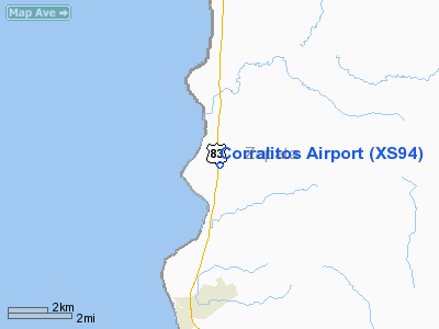
Location & QuickFacts
| FAA Information Effective: | 2008-09-25 |
| Airport Identifier: | XS94 |
| Airport Status: | Operational |
| Longitude/Latitude: | 099-25-21.1440W/27-06-41.1070N
-99.422540/27.111419 (Estimated) |
| Elevation: | 360 ft / 109.73 m (Estimated) |
| Land: | 0 acres |
| From nearest city: | 4 nautical miles N of San Ygnacio, TX |
| Location: | Zapata County, TX |
| Magnetic Variation: | 08E (1985) |
Owner & Manager
| Ownership: | Privately owned |
| Owner: | Lannie Mecom |
| Address: | Po Box 460
Chappell Hill, TX 77426 |
| Phone number: | 409-277-0600 |
| Manager: | Rafael Arambula |
| Address: | Po Box 460
Chappell Hill, TX 77426 |
| Phone number: | 409-277-0600 |
Airport Operations and Facilities
| Airport Use: | Private |
| Wind indicator: | Yes |
| Segmented Circle: | No |
| Control Tower: | No |
| Landing fee charge: | No |
| Sectional chart: | Brownsville |
| Region: | ASW - Southwest |
| Boundary ARTCC: | ZHU - Houston |
| Tie-in FSS: | SJT - San Angelo |
| FSS on Airport: | No |
| FSS Toll Free: | 1-800-WX-BRIEF |
Airport Services
| Airframe Repair: | NONE |
| Power Plant Repair: | NONE |
Runway Information
Runway 17/35
| Dimension: | 5500 x 100 ft / 1676.4 x 30.5 m |
| Surface: | ASPH, |
| |
Runway 17 |
Runway 35 |
| Traffic Pattern: | Left | Left |
|
Radio Navigation Aids
| ID |
Type |
Name |
Ch |
Freq |
Var |
Dist |
| HBV | NDB | Hebbronville | | 266.00 | 06E | 39.1 nm |
| NLD | VOR/DME | Nuevo Laredo | 073X | 112.60 | 09E | 20.8 nm |
| LRD | VORTAC | Laredo | 121X | 117.40 | 09E | 22.1 nm |
Images and information placed above are from
http://www.airport-data.com/airport/XS94/
We thank them for the data!
| General Info
|
| Country |
United States
|
| State |
TEXAS
|
| FAA ID |
XS94
|
| Latitude |
27-06-41.107N
|
| Longitude |
099-25-21.144W
|
| Elevation |
360 feet
|
| Near City |
SAN YGNACIO
|
We don't guarantee the information is fresh and accurate. The data may
be wrong or outdated.
For more up-to-date information please refer to other sources.
|
|


