 |
|
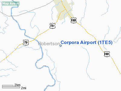
Location & QuickFacts
| FAA Information Effective: | 2008-09-25 |
| Airport Identifier: | 1TE5 |
| Airport Status: | Operational |
| Longitude/Latitude: | 096-36-03.8930W/30-48-58.6920N
-96.601081/30.816303 (Estimated) |
| Elevation: | 270 ft / 82.30 m (Estimated) |
| Land: | 0 acres |
| From nearest city: | 4 nautical miles S of Hearne, TX |
| Location: | Robertson County, TX |
| Magnetic Variation: | 06E (1985) |
Owner & Manager
| Ownership: | Privately owned |
| Owner: | Joseph S. Corpora |
| Address: | Box 867
Hearne, TX 77859 |
| Phone number: | 713-279-3122 |
| Manager: | Sam A. Corpora |
| Address: | Po Box 867
Hearne, TX 77859 |
| Phone number: | 713-279-3122 |
Airport Operations and Facilities
| Airport Use: | Private |
| Wind indicator: | Yes |
| Segmented Circle: | No |
| Control Tower: | No |
| Landing fee charge: | No |
| Sectional chart: | Houston |
| Region: | ASW - Southwest |
| Boundary ARTCC: | ZHU - Houston |
| Tie-in FSS: | CXO - Montgomery County |
| FSS on Airport: | No |
| FSS Toll Free: | 1-800-WX-BRIEF
FOR FP FILING CALL CXO FSS 1-800-833-5602. |
Airport Services
| Fuel available: | 100 80 |
| Airframe Repair: | NONE |
| Power Plant Repair: | NONE |
Runway Information
Runway 14/32
| Dimension: | 2500 x 35 ft / 762.0 x 10.7 m |
| Surface: | ASPH-TURF,
1540' ASPH. |
| |
Runway 14 |
Runway 32 |
| Traffic Pattern: | Left | Left |
|
Radio Navigation Aids
| ID |
Type |
Name |
Ch |
Freq |
Var |
Dist |
| BNH | NDB | Brenham | | 362.00 | 06E | 37.6 nm |
| GYB | NDB | Lee County | | 385.00 | 07E | 43.5 nm |
| ROB | NDB | Robinson | | 400.00 | 07E | 47.8 nm |
| LXY | NDB | Mexia | | 329.00 | 07E | 49.7 nm |
| GNL | VOR/DME | Groesbeck | 025X | 108.80 | 05E | 46.1 nm |
| TPL | VOR/DME | Temple | 041X | 110.40 | 09E | 48.6 nm |
| CLL | VORTAC | College Station | 080X | 113.30 | 08E | 15.8 nm |
| LOA | VORTAC | Leona | 045X | 110.80 | 08E | 37.5 nm |
| TNV | VORTAC | Navasota | 106X | 115.90 | 08E | 42.4 nm |
Remarks
- MAY BE EXEMPT UNDER GRANDFATHER CLAUSE.
Images and information placed above are from
http://www.airport-data.com/airport/1TE5/
We thank them for the data!
| General Info
|
| Country |
United States
|
| State |
TEXAS
|
| FAA ID |
1TE5
|
| Latitude |
30-48-58.692N
|
| Longitude |
096-36-03.893W
|
| Elevation |
270 feet
|
| Near City |
HEARNE
|
We don't guarantee the information is fresh and accurate. The data may
be wrong or outdated.
For more up-to-date information please refer to other sources.
|
|


