 |
|
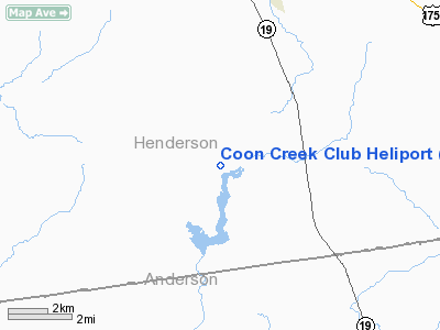
Location & QuickFacts
| FAA Information Effective: | 2008-09-25 |
| Airport Identifier: | XA87 |
| Airport Status: | Operational |
| Longitude/Latitude: | 095-51-01.1800W/32-04-42.2800N
-95.850328/32.078411 (Estimated) |
| Elevation: | 370 ft / 112.78 m (Estimated) |
| Land: | 1 acres |
| From nearest city: | 9 nautical miles E of Athens, TX |
| Location: | Henderson County, TX |
| Magnetic Variation: | () |
Owner & Manager
| Ownership: | Privately owned |
| Owner: | Coon Creek Club |
| Address: | 4809 Cola Ave, Suite 350, Lb 127
Dallas, TX 75205 |
| Phone number: | 214-526-9714 |
| Manager: | Jimmy Holder |
| Address: | 1700 Cr 1106-w06
Athens, TX 75751 |
| Phone number: | 903-338-2470 |
Airport Operations and Facilities
| Airport Use: | Private |
| Control Tower: | No |
| Lighting Schedule: | PHONE REQ
FOR PERIMETER LGTS CALL 903-338-2470. |
| Sectional chart: | Houston |
| Region: | ASW - Southwest |
| Boundary ARTCC: | ZFW - Fort Worth |
| Tie-in FSS: | FTW - Fort Worth |
| FSS Phone: | 817-541-3474 |
| FSS Toll Free: | 1-800-WX-BRIEF |
Runway Information
Helipad H1
| Dimension: | 40 x 40 ft / 12.2 x 12.2 m |
| Surface: | CONC, |
| |
Runway H1 |
Runway |
| Traffic Pattern: | Left | Left |
|
Radio Navigation Aids
| ID |
Type |
Name |
Ch |
Freq |
Var |
Dist |
| AHX | NDB | Athens | | 269.00 | 06E | 5.0 nm |
| CSZ | NDB | Crossroads | | 215.00 | 08E | 5.5 nm |
| LIQ | NDB | Lochridge Ranch | | 335.00 | 09E | 6.6 nm |
| PSN | NDB | Palestine | | 375.00 | 04E | 19.5 nm |
| PYF | NDB | Pyramid | | 418.00 | 06E | 21.9 nm |
| CRS | NDB | Corsicana | | 396.00 | 06E | 27.9 nm |
| TY | NDB | Tyler | | 320.00 | 06E | 28.0 nm |
| CGQ | NDB | Powell | | 344.00 | 06E | 29.4 nm |
| JSO | NDB | Cherokee County | | 263.00 | 05E | 34.7 nm |
| LXY | NDB | Mexia | | 329.00 | 07E | 42.9 nm |
| AVZ | NDB | Travis | | 260.00 | 06E | 45.7 nm |
| ABG | NDB | Ambassador | | 404.00 | 07E | 48.3 nm |
| JUG | NDB | Jecca | | 388.00 | 06E | 49.5 nm |
| FZT | VOR/DME | Frankston | 051X | 111.40 | 06E | 16.3 nm |
| TYR | VOR/DME | Tyler | 089X | 114.20 | 06E | 28.2 nm |
| GNL | VOR/DME | Groesbeck | 025X | 108.80 | 05E | 46.5 nm |
| CQY | VORTAC | Cedar Creek | 095X | 114.80 | 06E | 19.8 nm |
Remarks
- SEE AIRSPACE DETERMINATION DATED 4/6/05 FOR CONDS.
Images and information placed above are from
http://www.airport-data.com/airport/XA87/
We thank them for the data!
|
|


