 |
|
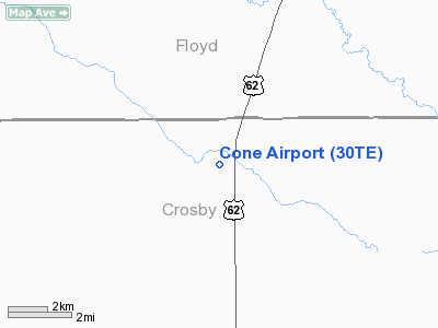
Location & QuickFacts
| FAA Information Effective: | 2008-09-25 |
| Airport Identifier: | 30TE |
| Airport Status: | Operational |
| Longitude/Latitude: | 101-23-46.5670W/33-48-40.2960N
-101.396269/33.811193 (Estimated) |
| Elevation: | 3144 ft / 958.29 m (Estimated) |
| Land: | 20 acres |
| From nearest city: | 7 nautical miles N of Ralls, TX |
| Location: | Crosby County, TX |
| Magnetic Variation: | 09E (1985) |
Owner & Manager
| Ownership: | Privately owned |
| Owner: | Kenny Adams |
| Address: | P O Box 811
Ralls, TX 79357 |
| Phone number: | 806-253-2892 |
| Manager: | Leo Suhr |
| Address: | P O Box 190
Ralls, TX 79357 |
| Phone number: | 806-253-2832 |
Airport Operations and Facilities
| Airport Use: | Private |
| Wind indicator: | Yes |
| Segmented Circle: | No |
| Control Tower: | No |
| Landing fee charge: | No |
| Sectional chart: | Dallas-ft Worth |
| Region: | ASW - Southwest |
| Boundary ARTCC: | ZFW - Fort Worth |
| Tie-in FSS: | FTW - Fort Worth |
| FSS on Airport: | No |
| FSS Phone: | 817-541-3474 |
| FSS Toll Free: | 1-800-WX-BRIEF |
Airport Communications
Airport Services
| Fuel available: | 100LLA |
| Airframe Repair: | NONE |
| Power Plant Repair: | NONE |
Runway Information
Runway 08/26
| Dimension: | 2500 x 80 ft / 762.0 x 24.4 m |
| Surface: | TURF, Fair Condition
SOFT & IREG WHEN WET.
NO SHOULDER EAST EDGE OF RWY; -2.5' DITCH 2' FROM EAST RWY EDGE. |
| |
Runway 08 |
Runway 26 |
| Traffic Pattern: | Left | Left |
| Obstruction: | 10 ft road | 15 ft road, 185.0 ft from runway, 12:1 slope to clear |
|
Runway 17/35
| Dimension: | 4270 x 60 ft / 1301.5 x 18.3 m |
| Surface: | TURF, Fair Condition
SOFT & IREG WHEN WET.
NO SHOULDER EAST EDGE OF RWY; -2.5' DITCH 2' FROM EAST RWY EDGE. |
| Edge Lights: | Low
NON-STD LIRL. |
| |
Runway 17 |
Runway 35 |
| Traffic Pattern: | Left | Left |
| Obstruction: | 15 ft road, 105.0 ft from runway, 7:1 slope to clear | 15 ft road, 0.0 ft from runway |
|
Radio Navigation Aids
| ID |
Type |
Name |
Ch |
Freq |
Var |
Dist |
| CZX | NDB | Crosbyton | | 332.00 | 09E | 13.7 nm |
| LIU | NDB | Littlefield | | 212.00 | 10E | 49.9 nm |
| PVW | VOR/DME | Plainview | 076X | 112.90 | 11E | 25.7 nm |
| LBB | VORTAC | Lubbock | 029X | 109.20 | 11E | 26.6 nm |
Images and information placed above are from
http://www.airport-data.com/airport/30TE/
We thank them for the data!
| General Info
|
| Country |
United States
|
| State |
TEXAS
|
| FAA ID |
30TE
|
| Latitude |
33-48-40.296N
|
| Longitude |
101-23-46.567W
|
| Elevation |
3144 feet
|
| Near City |
RALLS
|
We don't guarantee the information is fresh and accurate. The data may
be wrong or outdated.
For more up-to-date information please refer to other sources.
|
|


