 |
|
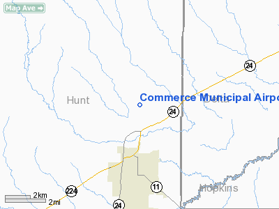
Location & QuickFacts
| FAA Information Effective: | 2008-09-25 |
| Airport Identifier: | 2F7 |
| Airport Status: | Operational |
| Longitude/Latitude: | 095-53-47.1000W/33-17-34.4000N
-95.896417/33.292889 (Estimated) |
| Elevation: | 515 ft / 156.97 m (Surveyed) |
| Land: | 132 acres |
| From nearest city: | 3 nautical miles N of Commerce, TX |
| Location: | Hunt County, TX |
| Magnetic Variation: | 08E (1965) |
Owner & Manager
| Ownership: | Publicly owned |
| Owner: | City Of Commerce |
| Address: | 1119 Alamo
Commerce, TX 75428 |
| Phone number: | 903-886-1100 |
| Manager: | Stephen Wilson
DIRECTOR OF COMMUNITY DEVELOPMENT. |
| Address: | 1119 Alamo
Commerce, TX 75428 |
| Phone number: | 903-886-1101 |
Airport Operations and Facilities
| Airport Use: | Open to public |
| Wind indicator: | Yes |
| Segmented Circle: | Yes |
| Control Tower: | No |
| Lighting Schedule: | DUSK-DAWN |
| Beacon Color: | Clear-Green (lighted land airport) |
| Landing fee charge: | No |
| Sectional chart: | Dallas-ft Worth |
| Region: | ASW - Southwest |
| Boundary ARTCC: | ZFW - Fort Worth |
| Tie-in FSS: | FTW - Fort Worth |
| FSS on Airport: | No |
| FSS Phone: | 817-541-3474 |
| FSS Toll Free: | 1-800-WX-BRIEF |
| NOTAMs Facility: | FTW (NOTAM-d service avaliable) |
| Federal Agreements: | NGY |
Airport Communications
Airport Services
| Fuel available: | 100LL
FUEL SERVICE AVBL WITH MAJOR CREDIT CARD ONLY. |
| Airframe Repair: | NONE |
| Power Plant Repair: | NONE |
| Bottled Oxygen: | NONE |
| Bulk Oxygen: | NONE |
Runway Information
Runway 18/36
| Dimension: | 3909 x 60 ft / 1191.5 x 18.3 m |
| Surface: | ASPH, Fair Condition |
| Weight Limit: | Single wheel: 13000 lbs. |
| Edge Lights: | Medium |
| |
Runway 18 |
Runway 36 |
| Longitude: | 095-53-46.0155W | 095-53-48.1500W |
| Latitude: | 33-17-53.6628N | 33-17-15.0316N |
| Elevation: | 515.00 ft | 506.00 ft |
| Alignment: | 127 | 3 |
| Traffic Pattern: | Left | Left |
| Markings: | Non-precision instrument, Good Condition | Non-precision instrument, Good Condition |
| Obstruction: | 15 ft road, 710.0 ft from runway, 34:1 slope to clear | 36 ft tree, 1800.0 ft from runway, 50 ft left of centerline, 44:1 slope to clear |
|
Radio Navigation Aids
| ID |
Type |
Name |
Ch |
Freq |
Var |
Dist |
| SYW | NDB | Cash | | 428.00 | 05E | 20.6 nm |
| MII | NDB | Caddo Mills | | 316.00 | 06E | 23.3 nm |
| HJM | NDB | Rayburn | | 415.00 | 06E | 23.9 nm |
| AVZ | NDB | Travis | | 260.00 | 06E | 36.6 nm |
| PQF | NDB | Mesquite | | 248.00 | 06E | 43.1 nm |
| DUA | NDB | Durant | | 359.00 | 05E | 46.5 nm |
| HHW | NDB | Hugo | | 323.00 | 05E | 48.3 nm |
| JUG | NDB | Jecca | | 388.00 | 06E | 49.4 nm |
| MJF | TACAN | Arvilla | 033X | | 05E | 16.0 nm |
| SLR | VOR/DME | Sulphur Springs | 027X | 109.00 | 08E | 18.7 nm |
| PRX | VOR/DME | Paris | 083X | 113.60 | 07E | 27.0 nm |
| UIM | VOR/DME | Quitman | 087X | 114.00 | 08E | 36.4 nm |
| URH | VOR/DME | Texoma | 090X | 114.30 | 05E | 46.3 nm |
| BYP | VORTAC | Bonham | 093X | 114.60 | 06E | 22.4 nm |
Remarks
Images and information placed above are from
http://www.airport-data.com/airport/2F7/
We thank them for the data!
| General Info
|
| Country |
United States
|
| State |
TEXAS
|
| FAA ID |
2F7
|
| Latitude |
33-17-34.400N
|
| Longitude |
095-53-47.105W
|
| Elevation |
515 feet
|
| Near City |
COMMERCE
|
We don't guarantee the information is fresh and accurate. The data may
be wrong or outdated.
For more up-to-date information please refer to other sources.
|
|


