 |
|
Location & QuickFacts
| FAA Information Effective: | 2008-09-25 |
| Airport Identifier: | 5TE0 |
| Airport Status: | Operational |
| Longitude/Latitude: | 100-09-32.2350W/28-37-40.9300N
-100.158954/28.628036 (Estimated) |
| Elevation: | 730 ft / 222.50 m (Estimated) |
| Land: | 0 acres |
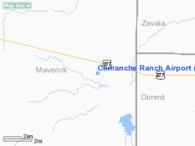
| From nearest city: | 19 nautical miles E of Eagle Pass, TX |
| Location: | Maverick County, TX |
| Magnetic Variation: | 07E (2005) |
Owner & Manager
| Ownership: | Privately owned |
| Owner: | Comanche Maverick Llc |
| Address: | Po Box 489
Carrizo Springs, TX 78834 |
| Phone number: | 830-757-9077 |
| Manager: | Keith Evans |
| Address: | 12888 Hwy 6 South
Sugarland, TX 77478 |
| Phone number: | 281-242-3300 |
Airport Operations and Facilities
| Airport Use: | Private |
| Wind indicator: | Yes |
| Segmented Circle: | Yes |
| Control Tower: | No |
| Lighting Schedule: | RDO CTL
ACTVT HIRL RY 15/33, REIL & PAPI RYS 15 & 33 - 123.3. |
| Landing fee charge: | No |
| Sectional chart: | San Antonio |
| Region: | ASW - Southwest |
| Boundary ARTCC: | ZHU - Houston |
| Tie-in FSS: | SJT - San Angelo |
| FSS on Airport: | No |
| FSS Toll Free: | 1-800-WX-BRIEF |
Airport Services
| Airframe Repair: | NONE |
| Power Plant Repair: | NONE |
Runway Information
Runway 15/33
| Dimension: | 5500 x 80 ft / 1676.4 x 24.4 m |
| Surface: | ASPH, |
| Edge Lights: | High |
| |
Runway 15 |
Runway 33 |
| Traffic Pattern: | Left | Left |
| Markings: | Non-precision instrument, Good Condition | Non-precision instrument, Good Condition |
| Obstruction: | 12 ft vehicle, 620.0 ft from runway | 57 ft pole, 1866.0 ft from runway |
|
Radio Navigation Aids
| ID |
Type |
Name |
Ch |
Freq |
Var |
Dist |
| DMD | NDB | Dimmit County | | 343.00 | 07E | 18.6 nm |
| CPZ | NDB | Chaparrosa Ranch | | 385.00 | 10E | 18.8 nm |
| LKX | NDB | La Pryor | | 223.00 | 09E | 24.2 nm |
| PFO | NDB | Spofford | | 356.00 | 08E | 34.2 nm |
| UVA | NDB | Uvalde | | 281.00 | 07E | 40.1 nm |
| BRX | NDB | La Fonda Ranch | | 269.00 | 09E | 42.6 nm |
Remarks
- TIEDOWNS AVBL.
- RY 15 HAS 4-BOX PAPI LEFT SIDE OF RY & REIL.
- RY 33 HAS 4-BOX PAPI RIGHT SIDE OF RY & REIL.
Images and information placed above are from
http://www.airport-data.com/airport/5TE0/
We thank them for the data!
| General Info
|
| Country |
United States
|
| State |
TEXAS
|
| FAA ID |
5TE0
|
| Latitude |
28-37-40.930N
|
| Longitude |
100-09-32.235W
|
| Elevation |
730 feet
|
| Near City |
EAGLE PASS
|
We don't guarantee the information is fresh and accurate. The data may
be wrong or outdated.
For more up-to-date information please refer to other sources.
|
|


