|
|
 |
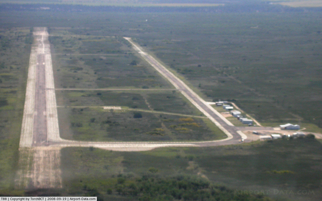
(Click on the photo to enlarge) |
Location & QuickFacts
| FAA Information Effective: | 2008-09-25 |
| Airport Identifier: | T88 |
| Airport Status: | Operational |
| Longitude/Latitude: | 100-55-16.0400W/32-28-06.3420N
-100.921122/32.468428 (Estimated) |
| Elevation: | 2214 ft / 674.83 m (Estimated) |
| Land: | 519 acres |
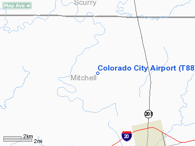
| From nearest city: | 6 nautical miles NW of Colorado City, TX |
| Location: | Mitchell County, TX |
| Magnetic Variation: | 08E (1985) |
Owner & Manager
| Ownership: | Publicly owned |
| Owner: | City Of Colorado City |
| Address: | Po Box 912
Colorado City, TX 79512 |
| Phone number: | 325-728-3464 |
| Manager: | Paul Catoe
CITY MGR. |
| Address: | Po Box 912
Colorado City, TX 79512 |
| Phone number: | 325-728-3464 |
Airport Operations and Facilities
| Airport Use: | Open to public |
| Wind indicator: | Yes |
| Segmented Circle: | Yes |
| Control Tower: | No |
| Lighting Schedule: | DUSK-DAWN |
| Beacon Color: | Clear-Green (lighted land airport) |
| Landing fee charge: | No |
| Sectional chart: | Dallas-ft Worth |
| Region: | ASW - Southwest |
| Boundary ARTCC: | ZFW - Fort Worth |
| Tie-in FSS: | FTW - Fort Worth |
| FSS on Airport: | No |
| FSS Phone: | 817-541-3474 |
| FSS Toll Free: | 1-800-WX-BRIEF |
| NOTAMs Facility: | FTW (NOTAM-d service avaliable) |
| Federal Agreements: | PY |
Airport Communications
Airport Services
| Airframe Repair: | NONE |
| Power Plant Repair: | NONE |
| Bottled Oxygen: | NONE |
| Bulk Oxygen: | NONE |
Runway Information
Runway 17/35
| Dimension: | 5420 x 60 ft / 1652.0 x 18.3 m
PAVEMENT FM RY 35 THLD LGTS SOUTHWARD USED AS A TWY AND NOT MAINTAINED. |
| Surface: | ASPH, Fair Condition |
| Weight Limit: | Single wheel: 50000 lbs. |
| Edge Lights: | Low |
| |
Runway 17 |
Runway 35 |
| Longitude: | 100-55-15.4850W | 100-55-16.5950W |
| Latitude: | 32-28-33.4460N | 32-27-39.2370N |
| Elevation: | 2214.00 ft | 2205.00 ft |
| Alignment: | 127 | 1 |
| Traffic Pattern: | Left | Left |
| Markings: | Basic, Good Condition | Basic, Good Condition |
|
Radio Navigation Aids
| ID |
Type |
Name |
Ch |
Freq |
Var |
Dist |
| SDR | NDB | Snyder | | 359.00 | 08E | 14.1 nm |
| SWW | NDB | Sweetwater | | 275.00 | 08E | 23.1 nm |
| BGS | VORTAC | Big Spring | 090X | 114.30 | 11E | 29.0 nm |
Images and information placed above are from
http://www.airport-data.com/airport/T88/
We thank them for the data!
| General Info
|
| Country |
United States
|
| State |
TEXAS
|
| FAA ID |
T88
|
| Latitude |
32-28-06.342N
|
| Longitude |
100-55-16.040W
|
| Elevation |
2214 feet
|
| Near City |
COLORADO CITY
|
We don't guarantee the information is fresh and accurate. The data may
be wrong or outdated.
For more up-to-date information please refer to other sources.
|
|