 |
|
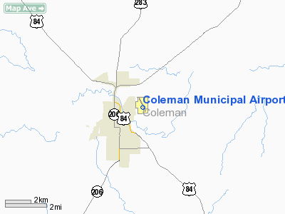
Location & QuickFacts
| FAA Information Effective: | 2008-09-25 |
| Airport Identifier: | COM |
| Airport Status: | Operational |
| Longitude/Latitude: | 099-24-13.0000W/31-50-28.1000N
-99.403611/31.841139 (Estimated) |
| Elevation: | 1697 ft / 517.25 m (Surveyed) |
| Land: | 297 acres |
| From nearest city: | 2 nautical miles NE of Coleman, TX |
| Location: | Coleman County, TX |
| Magnetic Variation: | 07E (2000) |
Owner & Manager
| Ownership: | Publicly owned |
| Owner: | City Of Coleman |
| Address: | Po Box 592
Coleman, TX 76834 |
| Phone number: | 325-625-5114 |
| Manager: | Randy Long |
| Address: | 503 Airport Lane
Coleman, TX 76834 |
| Phone number: | 325-625-2293
OR 325-625-5495. |
Airport Operations and Facilities
| Airport Use: | Open to public |
| Wind indicator: | Yes |
| Segmented Circle: | Yes |
| Control Tower: | No |
| Lighting Schedule: | DUSK-DAWN |
| Beacon Color: | Clear-Green (lighted land airport) |
| Landing fee charge: | No |
| Sectional chart: | San Antonio |
| Region: | ASW - Southwest |
| Boundary ARTCC: | ZFW - Fort Worth |
| Tie-in FSS: | FTW - Fort Worth |
| FSS on Airport: | No |
| FSS Phone: | 817-541-3474 |
| FSS Toll Free: | 1-800-WX-BRIEF |
| NOTAMs Facility: | FTW (NOTAM-d service avaliable) |
| Federal Agreements: | NGRY3 |
Airport Communications
| CTAF: | 122.800 |
| Unicom: | 122.800
UNICOM UNMONITORED INDEFLY. |
Airport Services
| Fuel available: | 100LL |
| Airframe Repair: | MAJOR |
| Power Plant Repair: | MAJOR |
Runway Information
Runway 15/33
| Dimension: | 4503 x 75 ft / 1372.5 x 22.9 m |
| Surface: | ASPH, Good Condition |
| Weight Limit: | Single wheel: 12500 lbs. |
| Edge Lights: | Medium |
| |
Runway 15 |
Runway 33 |
| Longitude: | 099-24-23.9590W | 099-24-02.0260W |
| Latitude: | 31-50-48.3260N | 31-50-07.8920N |
| Elevation: | 1697.00 ft | 1680.00 ft |
| Alignment: | 127 | 127 |
| Traffic Pattern: | Left | Left |
| Markings: | Non-precision instrument, Good Condition | Non-precision instrument, Good Condition |
| Runway End Identifier: | Yes | Yes |
| Obstruction: | 10 ft road, 674.0 ft from runway, 47:1 slope to clear | 14 ft trees, 681.0 ft from runway, 34:1 slope to clear |
|
Radio Navigation Aids
| ID |
Type |
Name |
Ch |
Freq |
Var |
Dist |
| COM | NDB | Coleman | | 385.00 | 07E | 0.1 nm |
| IEW | NDB | Winters | | 396.00 | 08E | 30.5 nm |
| UBC | NDB | Ballinger | | 239.00 | 08E | 30.8 nm |
| BBD | NDB | Brady | | 380.00 | 07E | 40.1 nm |
| OIP | NDB | Old Rip | | 410.00 | 07E | 45.1 nm |
| DYS | TACAN | Dyess | 063X | | 08E | 41.7 nm |
| BWD | VOR/DME | Brownwood | 023X | 108.60 | 08E | 23.0 nm |
| TQA | VOR/DME | Tuscola | 053X | 111.60 | 10E | 31.7 nm |
| ABI | VORTAC | Abilene | 084X | 113.70 | 10E | 45.0 nm |
Remarks
- MULTIPLE 65 FT TEMPORARY CRANES 1300 FT NW AER 15.
Images and information placed above are from
http://www.airport-data.com/airport/COM/
We thank them for the data!
| General Info
|
| Country |
United States
|
| State |
TEXAS
|
| FAA ID |
COM
|
| Latitude |
31-50-28.100N
|
| Longitude |
099-24-13.000W
|
| Elevation |
1697 feet
|
| Near City |
COLEMAN
|
We don't guarantee the information is fresh and accurate. The data may
be wrong or outdated.
For more up-to-date information please refer to other sources.
|
|


