 |
|
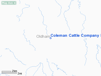
Coleman Cattle Company Nr 2 Airport |
Location & QuickFacts
| FAA Information Effective: | 2008-09-25 |
| Airport Identifier: | 76TA |
| Airport Status: | Operational |
| Longitude/Latitude: | 102-48-27.7710W/35-24-06.1880N
-102.807714/35.401719 (Estimated) |
| Elevation: | 3820 ft / 1164.34 m (Estimated) |
| Land: | 0 acres |
| From nearest city: | 11 nautical miles NW of Adrian, TX |
| Location: | Oldham County, TX |
| Magnetic Variation: | 10E (1985) |
Owner & Manager
| Ownership: | Privately owned |
| Owner: | Coleman Cattle Company |
| Address: | Box 178
Ackerly, TX 79713 |
| Phone number: | 915-353-4353 |
| Manager: | Mike Coleman |
| Address: | Box 178
Ackerly, TX 79713 |
| Phone number: | 915-353-4353 |
Airport Operations and Facilities
| Airport Use: | Private |
| Wind indicator: | Yes |
| Segmented Circle: | No |
| Control Tower: | No |
| Sectional chart: | Albuquerque |
| Region: | ASW - Southwest |
| Boundary ARTCC: | ZAB - Albuquerque |
| Tie-in FSS: | FTW - Fort Worth |
| FSS on Airport: | No |
| FSS Phone: | 817-541-3474 |
| FSS Toll Free: | 1-800-WX-BRIEF |
Runway Information
Runway 03/21
| Dimension: | 3500 x 50 ft / 1066.8 x 15.2 m |
| Surface: | ASPH, |
| |
Runway 03 |
Runway 21 |
| Traffic Pattern: | Left | Left |
|
Radio Navigation Aids
| ID |
Type |
Name |
Ch |
Freq |
Var |
Dist |
| HRX | NDB | Hereford | | 341.00 | 09E | 40.5 nm |
| DUX | NDB | Durrett | | 414.00 | 09E | 47.7 nm |
| TCC | VORTAC | Tucumcari | 083X | 113.60 | 12E | 41.0 nm |
| DHT | VORTAC | Dalhart | 057X | 112.00 | 12E | 43.4 nm |
Images and information placed above are from
http://www.airport-data.com/airport/76TA/
We thank them for the data!
| General Info
|
| Country |
United States
|
| State |
TEXAS
|
| FAA ID |
76TA
|
| Latitude |
35-24-06.188N
|
| Longitude |
102-48-27.771W
|
| Elevation |
3820 feet
|
| Near City |
ADRIAN
|
We don't guarantee the information is fresh and accurate. The data may
be wrong or outdated.
For more up-to-date information please refer to other sources.
|
|


